

Pine Apple is a town in Wilcox County, Alabama, United States. It incorporated in 1872.[2] Per the 2020 census, the population was 143.[3] It has two places on the National Register of Historic Places, the Hawthorne House and the Pine Apple Historic District.[4]
History
Pine Apple was originally called Friendship, and under the latter name was laid out in 1825.[5] The present name was given in 1852 on account of there being pine and apple groves near the town site.[5]
Geography
Pine Apple is located at 31°52′4″N 86°59′15″W / 31.86778°N 86.98750°W (31.867882, -86.987624).[6]
According to the U.S. Census Bureau, the town has a total area of 3.1 square miles (8.0 km2), all land.
Demographics
| Census | Pop. | Note | %± |
|---|---|---|---|
| 1880 | 358 | — | |
| 1890 | 520 | 45.3% | |
| 1900 | 623 | 19.8% | |
| 1910 | 627 | 0.6% | |
| 1920 | 464 | −26.0% | |
| 1930 | 438 | −5.6% | |
| 1940 | 455 | 3.9% | |
| 1950 | 445 | −2.2% | |
| 1960 | 355 | −20.2% | |
| 1970 | 347 | −2.3% | |
| 1980 | 298 | −14.1% | |
| 1990 | 365 | 22.5% | |
| 2000 | 145 | −60.3% | |
| 2010 | 132 | −9.0% | |
| 2020 | 143 | 8.3% | |
| U.S. Decennial Census[7] 2010[8] 2020[9] | |||
2020 census
| Race / Ethnicity | Pop 2010[8] | Pop 2020[9] | % 2010 | % 2020 |
|---|---|---|---|---|
| White alone (NH) | 97 | 91 | 73.48% | 63.64% |
| Black or African American alone (NH) | 32 | 44 | 24.24% | 30.77% |
| Native American or Alaska Native alone (NH) | 1 | 0 | 0.76% | 0.00% |
| Asian alone (NH) | 1 | 0 | 0.76% | 0.00% |
| Pacific Islander alone (NH) | 1 | 2 | 0.76% | 1.40% |
| Some Other Race alone (NH) | 0 | 1 | 0.00% | 0.70% |
| Mixed Race/Multi-Racial (NH) | 0 | 2 | 0.00% | 1.40% |
| Hispanic or Latino (any race) | 0 | 3 | 0.00% | 2.10% |
| Total | 132 | 143 | 100.00% | 100.00% |
Note: the US Census treats Hispanic/Latino as an ethnic category. This table excludes Latinos from the racial categories and assigns them to a separate category. Hispanics/Latinos can be of any race.
2000 Census
At the 2000 census there were 145 people, 65 households, and 44 families in the town. The population density was 46.8 inhabitants per square mile (18.1/km2). There were 101 housing units at an average density of 32.6 per square mile (12.6/km2). The racial makeup of the town was 62.76% White, 36.55% Black or African American, and 0.69% from two or more races.[10] Of the 65 households 20.0% had children under the age of 18 living with them, 55.4% were married couples living together, 10.8% had a female householder with no husband present, and 32.3% were non-families. 32.3% of households were one person and 18.5% were one person aged 65 or older. The average household size was 2.23 and the average family size was 2.82.
The age distribution was 22.8% under the age of 18, 4.1% from 18 to 24, 22.8% from 25 to 44, 22.8% from 45 to 64, and 27.6% 65 or older. The median age was 45 years. For every 100 females, there were 81.3 males. For every 100 females age 18 and over, there were 80.6 males.
The median household income was $35,625 and the median family income was $44,583. Males had a median income of $29,583 versus $30,833 for females. The per capita income for the town was $16,876. There were 7.7% of families and 15.8% of the population living below the poverty line, including 35.9% of under eighteens and 14.3% of those over 64.
Notable people
- Fred Cone - a former running back in the NFL for the Green Bay Packers and Dallas Cowboys.
- Kenneth R. Giddens - Broadcaster and Voice of America executive.
- Philemon T. Herbert - former U.S. Representative from California
References
- ^ "2020 U.S. Gazetteer Files". United States Census Bureau. Retrieved October 29, 2021.
- ^ "Pine Apple".
- ^ "Pine Apple town, Alabama". United States Census Bureau. Retrieved April 15, 2022.
- ^ "National Register Information System". National Register of Historic Places. National Park Service. April 15, 2008.
- ^ a b "Pine Apple, Alabama Announced Front Poarch [sic] Tour". Thomasville News. March 8, 2006. p. 3. Retrieved May 29, 2015.
- ^ "US Gazetteer files: 2010, 2000, and 1990". United States Census Bureau. February 12, 2011. Retrieved April 23, 2011.
- ^ "Decennial Census of Population and Housing by Decades". US Census Bureau.
- ^ a b "P2 HISPANIC OR LATINO, AND NOT HISPANIC OR LATINO BY RACE – 2010: DEC Redistricting Data (PL 94-171) – Pine Hill town, Alabama". United States Census Bureau.
- ^ a b "P2 HISPANIC OR LATINO, AND NOT HISPANIC OR LATINO BY RACE – 2020: DEC Redistricting Data (PL 94-171) – Pine Hill town, Alabama". United States Census Bureau.
- ^ "U.S. Census website". United States Census Bureau. Retrieved January 31, 2008.
31°52′04″N 86°59′15″W / 31.867882°N 86.987624°W
Municipalities and communities of Wilcox County, Alabama, United States | ||
|---|---|---|
| City | 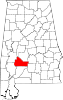 | |
| Towns | ||
| CDPs | ||
| Unincorporated communities | ||
| Ghost towns | ||