


Size of this preview: 400 × 600 pixels. Other resolutions: 160 × 240 pixels | 320 × 480 pixels | 512 × 768 pixels | 682 × 1,024 pixels | 1,365 × 2,048 pixels | 3,072 × 4,608 pixels.
Original file (3,072 × 4,608 pixels, file size: 7.13 MB, MIME type: image/jpeg)
Summary
| Description |
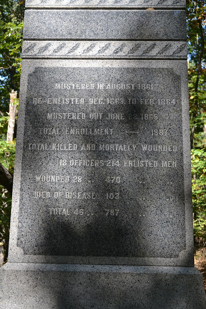
English: Detail of the 61st Pennsylvania Infantry Monument, Neill Avenue ("Lost Lane"), Gettysburg National Military Park |
| Date | |
| Source | Own work |
| Author | Veggies |
| Object location | | View this and other nearby images on: OpenStreetMap |
|---|
Licensing

|
The copyright holder of this file, Veggies, allows anyone to use it for any purpose, provided that the copyright holder is properly attributed. Redistribution, derivative work, commercial use, and all other use is permitted. |
Attribution:
Use or reproduction of this image outside of Wikipedia must give the original photographer (Veggies) credit
|
File history
Click on a date/time to view the file as it appeared at that time.
| Date/Time | Thumbnail | Dimensions | User | Comment | |
|---|---|---|---|---|---|
| current | 01:50, 24 September 2017 | | 3,072 × 4,608 (7.13 MB) | Veggies | User created page with UploadWizard |
File usage
The following pages on the English Wikipedia use this file (pages on other projects are not listed):