

Size of this preview: 800 × 402 pixels. Other resolutions: 320 × 161 pixels | 640 × 322 pixels | 1,024 × 515 pixels | 1,280 × 644 pixels | 2,060 × 1,036 pixels.
Original file (2,060 × 1,036 pixels, file size: 416 KB, MIME type: image/jpeg)
|
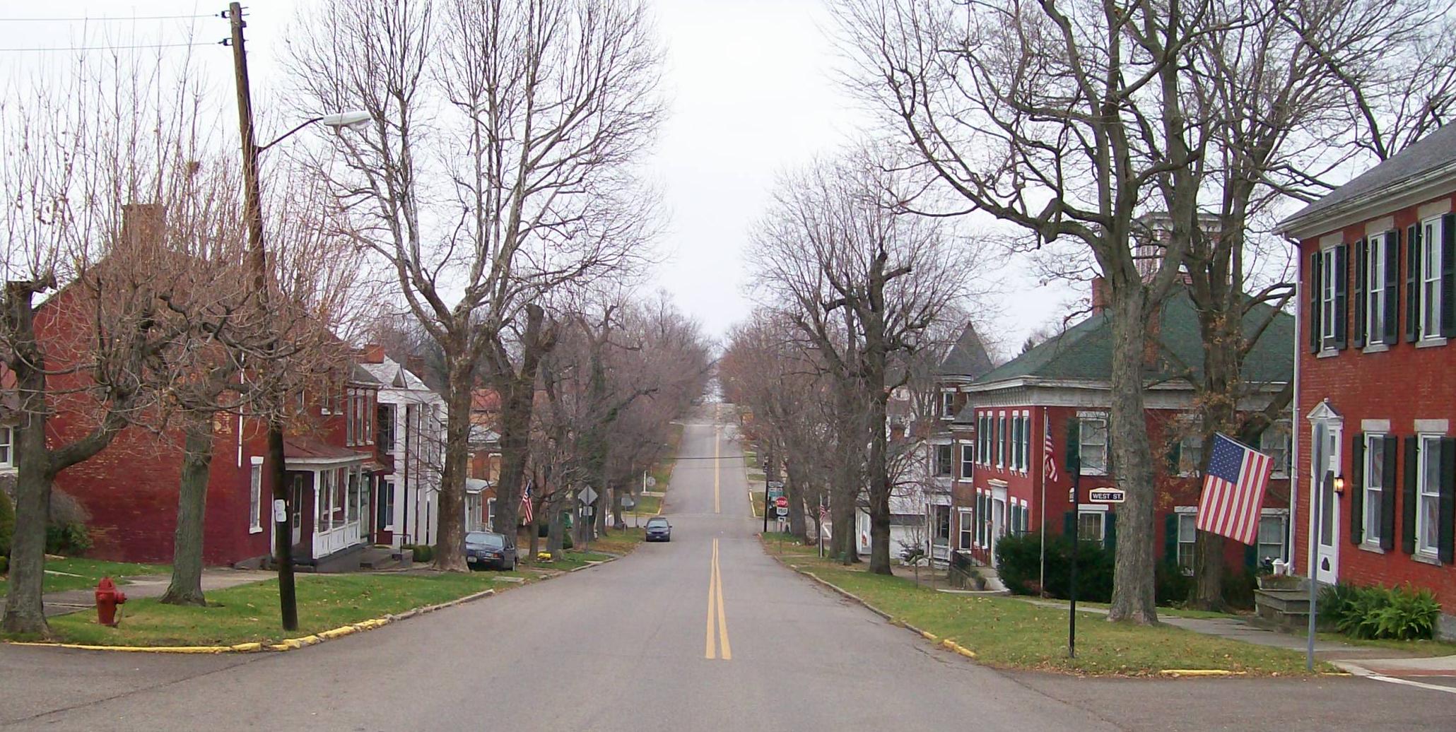
This is an image of a place or building that is listed on the National Register of Historic Places in the United States of America. Its reference number is 74001536. |
Summary
| Description |
English: The Mount Pleasant Historic District in Ohio looking east along Union Street from its junction with Market Street. The district was added to the National Register of Historic Places in 1974 for national significance in the abolitionist movement including being a stop on the Underground Railroad and intact architectural integrity. Taken on 2009-11-21. |
| Date | (UTC) |
| Source |
I (Bwsmith84 (talk)) created this work entirely by myself. Transferred from en.wikipedia |
| Author | Bwsmith84 (talk) |
| Permission (Reusing this file) |
Bwsmith84 at en.wikipedia, the copyright holder of this work, hereby publishes it under the following license: This file is licensed under the Creative Commons Attribution 3.0 Unported license. Attribution: Bwsmith84 at en.wikipedia
|
| Object location | | View this and other nearby images on: OpenStreetMap |
|---|
Original upload log
The original description page was here. All following user names refer to en.wikipedia.
- 2009-11-21 22:33 Bwsmith84 2060×1036 (425814 bytes) {{Information |Description = The Mount Plesant Historic Site looking from Market Street to the east. |Source = I (~~~) created this work entirely by myself. |Date = ~~~~~ |Author = ~~~ |other_versions = }}
File history
Click on a date/time to view the file as it appeared at that time.
| Date/Time | Thumbnail | Dimensions | User | Comment | |
|---|---|---|---|---|---|
| current | 09:42, 9 January 2012 | | 2,060 × 1,036 (416 KB) | BotMultichillT | {{BotMoveToCommons|en.wikipedia|year={{subst:CURRENTYEAR}}|month={{subst:CURRENTMONTHNAME}}|day={{subst:CURRENTDAY}}}} == {{int:filedesc}} == {{Information |description={{en|1=The Mount Pleasant Historic District in Ohio looking east along Union Street f |
File usage
The following pages on the English Wikipedia use this file (pages on other projects are not listed):
Global file usage
The following other wikis use this file:
- Usage on ar.wikipedia.org
- Usage on ca.wikipedia.org
- Usage on ceb.wikipedia.org
- Usage on cy.wikipedia.org
- Usage on es.wikipedia.org
- Usage on eu.wikipedia.org
- Usage on fr.wikipedia.org
- Usage on ht.wikipedia.org
- Usage on it.wikipedia.org
- Usage on lld.wikipedia.org
- Usage on pl.wikipedia.org
- Usage on pt.wikipedia.org
- Usage on sh.wikipedia.org
- Usage on sr.wikipedia.org
- Usage on uk.wikipedia.org
- Usage on vi.wikipedia.org
- Usage on www.wikidata.org
- Usage on zh-min-nan.wikipedia.org