

The Penzhina (Russian: Пенжина; Koryak: Мыгыкивэем) is a river in Kamchatka Krai, Russia. It is 713 kilometres (443 mi) long, and has a drainage basin of 73,500 square kilometres (28,400 sq mi).[1]
The name "Penzhina" originated the Chukchi word "Pennyn", meaning "place of attack". In Koryak it is known as "Wegykiveem" (Мыгыкивэем), meaning "stormy river".[2]
Course
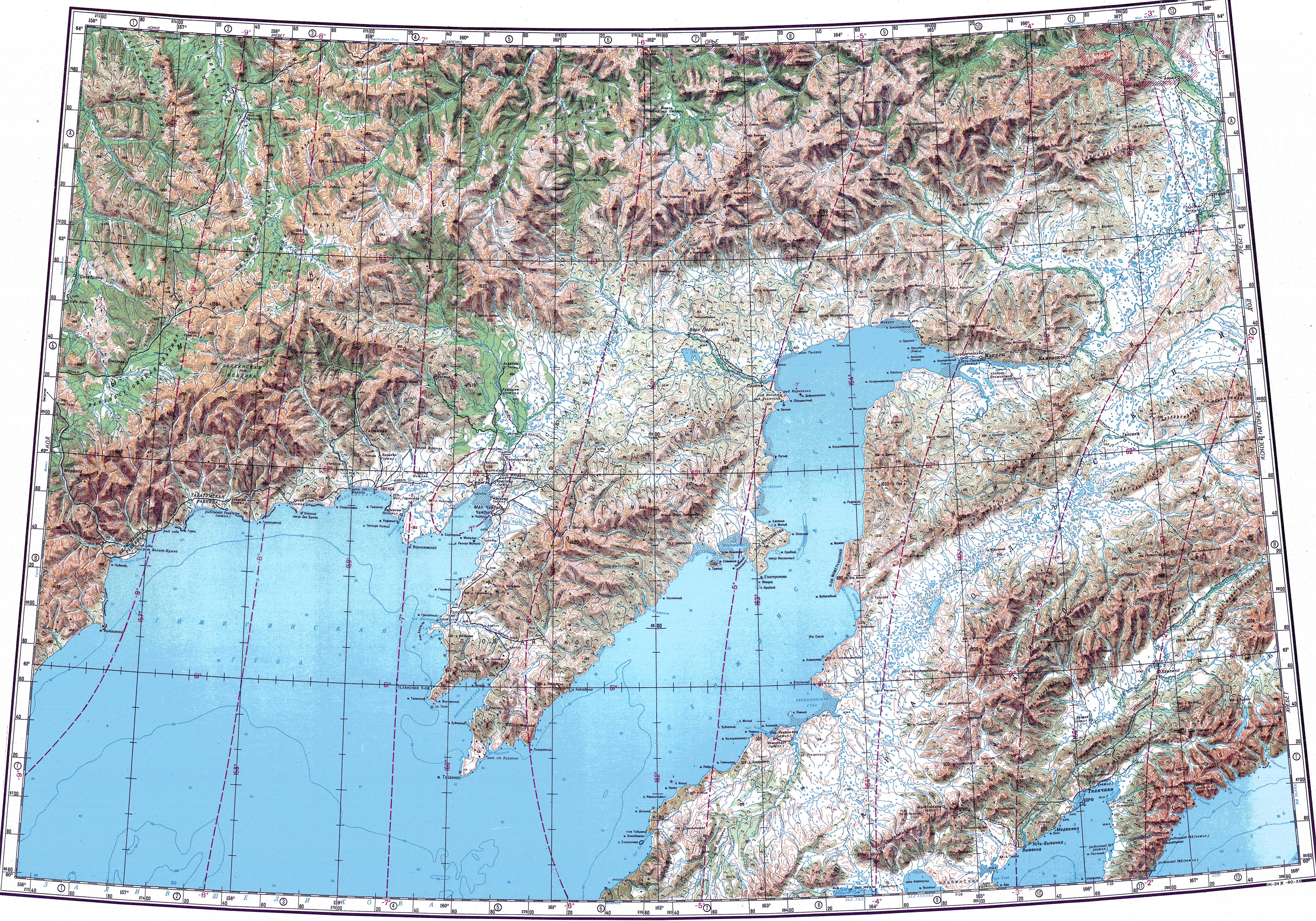
The source of the Penzhina is in the Kolyma Mountains, and it flows eastwards across the Ichigem Range. After bending southwards it enters a wide floodplain filled with lakes, finally flowing into the Penzhina Bay of the Sea of Okhotsk.[3][4][5][6]
The villages of Kamenskoye, Oklan, Slautnoye and Ayanka are located by the river, as well as the seaport of Manily.
Its main tributaries are the Shayboveyem, Kondyreva and Oklan from the right, and the Ayanka, Chyornaya and Belaya from the left.[3]
 |
Flora and fauna
Among the fish species in the river the Far Eastern brook lamprey, Pacific lamprey, pike, chir, Kamchatka grayling, pink salmon, chum salmon, coho salmon, Dolly Varden trout, kundzha, Levanidov char and burbot deserve mention.[6]
See also
References
- ^ "Река Пенжина in the State Water Register of Russia". textual.ru (in Russian).
- ^ Leontiev V.V. , Novikova K.A. Toponymic dictionary of the North-East of the USSR / scientific. ed. G. A. Menovshchikov ; FEB AS USSR . North-East complex. Research Institute. Lab. archeology, history and ethnography. - Magadan: Magadan . book. publishing house , 1989. - S. 290. - 456 p. — ISBN 5-7581-0044-7 .
- ^ a b Пенжина, Great Soviet Encyclopedia
- ^ "Топографска карта P-57_58 - Topographic USSR Chart (in Russian)". Retrieved 24 February 2022.
- ^ Google Earth
- ^ a b Water of Russia - Пенжина