

Size of this preview: 800 × 450 pixels. Other resolutions: 320 × 180 pixels | 640 × 360 pixels | 1,024 × 576 pixels | 1,280 × 720 pixels | 2,560 × 1,440 pixels | 7,360 × 4,140 pixels.
Original file (7,360 × 4,140 pixels, file size: 14.65 MB, MIME type: image/jpeg)
Summary
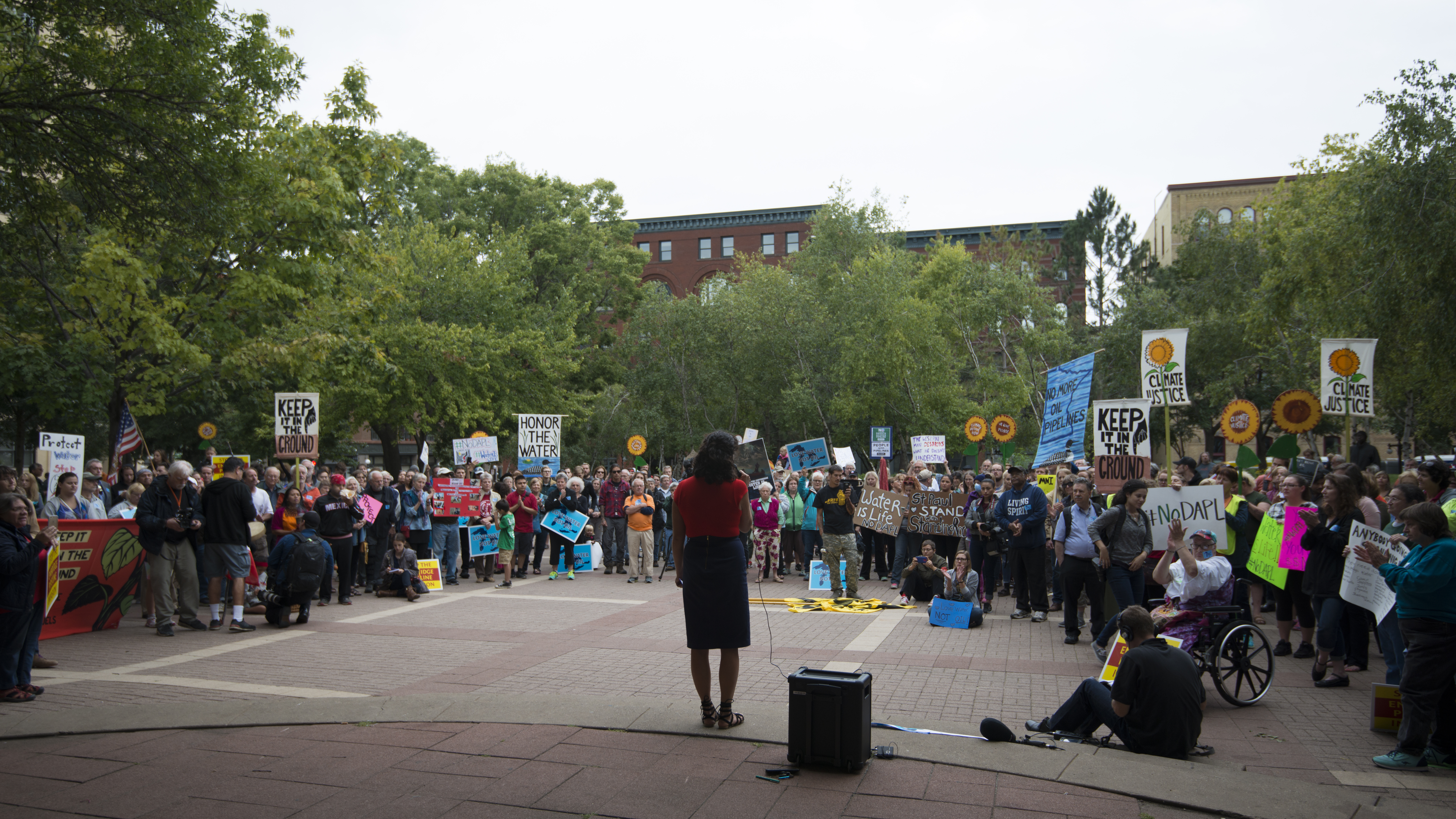
| Description | This was one of the solidarity rallies happening around the world this day to show support for the protests against the Dakota Access Pipeline. The planned pipeline will transport 470,000 barrels of oil per day 1,172 miles from North Dakota to Illinois. Protesters called for a stop of the pipeline construction which will pass upstream from the Standing Rock Sioux Nation. Along with the threat to their water supply, the tribe claims the pipeline will destroy burial sites and sacred places. |
| Date | |
| Source | Solidarity rally against the Dakota Access Pipeline |
| Author | Fibonacci Blue from Minnesota, USA |
| Camera location | | View this and other nearby images on: OpenStreetMap |
|---|
.jpg¶ms=044.949537_N_-093.088123_E_globe:Earth_type:camera_source:Flickr_&language=en)
Licensing
This file is licensed under the Creative Commons Attribution 2.0 Generic license.
- You are free:
- to share – to copy, distribute and transmit the work
- to remix – to adapt the work
- Under the following conditions:
- attribution – You must give appropriate credit, provide a link to the license, and indicate if changes were made. You may do so in any reasonable manner, but not in any way that suggests the licensor endorses you or your use.
| This image was originally posted to Flickr by Fibonacci Blue at https://flickr.com/photos/44550450@N04/29585235701. It was reviewed on 1 November 2016 by FlickreviewR and was confirmed to be licensed under the terms of the cc-by-2.0. |
File history
Click on a date/time to view the file as it appeared at that time.
| Date/Time | Thumbnail | Dimensions | User | Comment | |
|---|---|---|---|---|---|
| current | 21:39, 1 November 2016 | | 7,360 × 4,140 (14.65 MB) | Bogdan | Transferred from Flickr via Flickr2Commons |
File usage
The following pages on the English Wikipedia use this file (pages on other projects are not listed):
Global file usage
The following other wikis use this file:
- Usage on ru.wikipedia.org
.jpg)