

Abernant is an unincorporated community in Tuscaloosa County, Alabama, United States. Abernant is located along Alabama State Route 216, 3.6 miles (5.8 km) west of Lake View. Abernant has a post office with ZIP code 35440.[2][3]
Shares a name with Welsh settlements of Abernant, Rhondda Cynon Taf, Abernant, Powys and Abernant, Carmarthenshire. In the Welsh language, “Aber” is translated as Estuary and “Nant” is translated as Stream.
History
Abernant was named for a local family which also lent their name to a nearby coal company.[4] A post office has been in operation at Abernant since 1902.[5]
Demographics
Abernant Census Division (1960-)
| Census | Pop. | Note | %± |
|---|---|---|---|
| 1960 | 1,819 | — | |
| 1970 | 1,958 | 7.6% | |
| 1980 | 3,064 | 56.5% | |
| 1990 | 4,398 | 43.5% | |
| 2000 | 7,013 | 59.5% | |
| 2010 | 9,955 | 42.0% | |
| U.S. Decennial Census[6] | |||
Abernant village has never reported a population figure separately on the U.S. Census as an unincorporated community. However, the census division formed in 1960 was named for Abernant (superseding the former name of Parsons-Yolande, Precinct 12 of Tuscaloosa County).[7][8]
References
- ^ "Abernant". Geographic Names Information System. United States Geological Survey, United States Department of the Interior.
- ^ United States Postal Service (2012). "USPS - Look Up a ZIP Code". Retrieved February 15, 2012.
- ^ "Postmaster Finder - Post Offices by ZIP Code". United States Postal Service. Archived from the original on April 28, 2019. Retrieved June 4, 2013.
- ^ Foscue, Virginia O. (1989). Place Names in Alabama. University of Alabama Press. p. 5. ISBN 978-0-8173-0410-2.
- ^ "Tuscaloosa County". Jim Forte Postal History. Retrieved February 9, 2015.
- ^ "U.S. Decennial Census". Census.gov. Retrieved June 6, 2013.
- ^ Census data
- ^ Census data
Municipalities and communities of Tuscaloosa County, Alabama, United States | ||
|---|---|---|
| Cities | 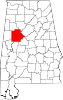 | |
| Towns | ||
| CDPs | ||
| Other unincorporated communities | ||
| Ghost town | ||
| Footnotes | ‡This populated place also has portions in an adjacent county or counties | |