Contents
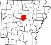
California Township is one of 22 townships in Faulkner County, Arkansas, USA.[1] As of the 2000 census, its unincorporated population was 1,467. The township experienced much unusual geologic activity with the Guy-Greenbrier earthquake swarm in 2010–2011.[2]
Geography
According to the United States Census Bureau, California Township covers an area of 36.3 square miles (94 km2); with 36.2 square miles (94 km2) being land and the remaining 0.1 square miles (0.26 km2) water.[1] Woolly Hollow State Park is in the southeast corner of the township.
Cities, towns, villages
Cemeteries
The township contains Copperas Springs Cemetery, King Cemetery, McNew Cemetery, Mode Cemetery, and Old Texas Cemetery.
Major routes
The township contains Arkansas Highway 25, Arkansas Highway 310, and Arkansas Highway 285. A very brief portion of U.S. Route 65 runs in the southwest corner of the township.
References
- United States Census Bureau 2008 TIGER/Line Shapefiles
- United States Board on Geographic Names (GNIS)
- United States National Atlas
- ^ a b "Township of California, Washington County, Arkansas." U.S. Census Bureau. Breakdown. Retrieved March 1, 2011.
- ^ "A Dot on the Map, Until the Earth Started Shaking". The New York Times. February 5, 2011. Retrieved March 1, 2011.
But in their sheer numbers, they have been relentless, creating a phenomenon that has come to be called the Guy earthquake swarm.


