

Size of this preview: 800 × 533 pixels. Other resolutions: 320 × 213 pixels | 640 × 427 pixels | 1,024 × 683 pixels | 1,280 × 853 pixels | 2,560 × 1,707 pixels | 5,400 × 3,600 pixels.
Original file (5,400 × 3,600 pixels, file size: 13.34 MB, MIME type: image/jpeg)
Summary
| Description | |
| Date | Taken on 23 December 2016 |
| Source | Own work |
| Author | 663highland |
| Camera Model | Sony ILCE-6000 |
|---|---|
| Lens | Sony SEL1670Z (Carl Zeiss) |
| Camera location | | View this and other nearby images on: OpenStreetMap |
|---|
Licensing
663highland, the copyright holder of this work, hereby publishes it under the following licenses:

|
Permission is granted to copy, distribute and/or modify this document under the terms of the GNU Free Documentation License, Version 1.2 or any later version published by the Free Software Foundation; with no Invariant Sections, no Front-Cover Texts, and no Back-Cover Texts. A copy of the license is included in the section entitled GNU Free Documentation License. |
| This file is licensed under the Creative Commons Attribution-Share Alike 3.0 Unported license. | ||
| Attribution: 663highland | ||
| ||
| This licensing tag was added to this file as part of the GFDL licensing update. |
This file is licensed under the Creative Commons Attribution 2.5 Generic license.
Attribution: 663highland
- You are free:
- to share – to copy, distribute and transmit the work
- to remix – to adapt the work
- Under the following conditions:
- attribution – You must give appropriate credit, provide a link to the license, and indicate if changes were made. You may do so in any reasonable manner, but not in any way that suggests the licensor endorses you or your use.
You may select the license of your choice.
File history
Click on a date/time to view the file as it appeared at that time.
| Date/Time | Thumbnail | Dimensions | User | Comment | |
|---|---|---|---|---|---|
| current | 22:20, 23 December 2016 | | 5,400 × 3,600 (13.34 MB) | 663highland | {{Information |Description= |Source= |Date= |Author= |Permission= |other_versions= }} |
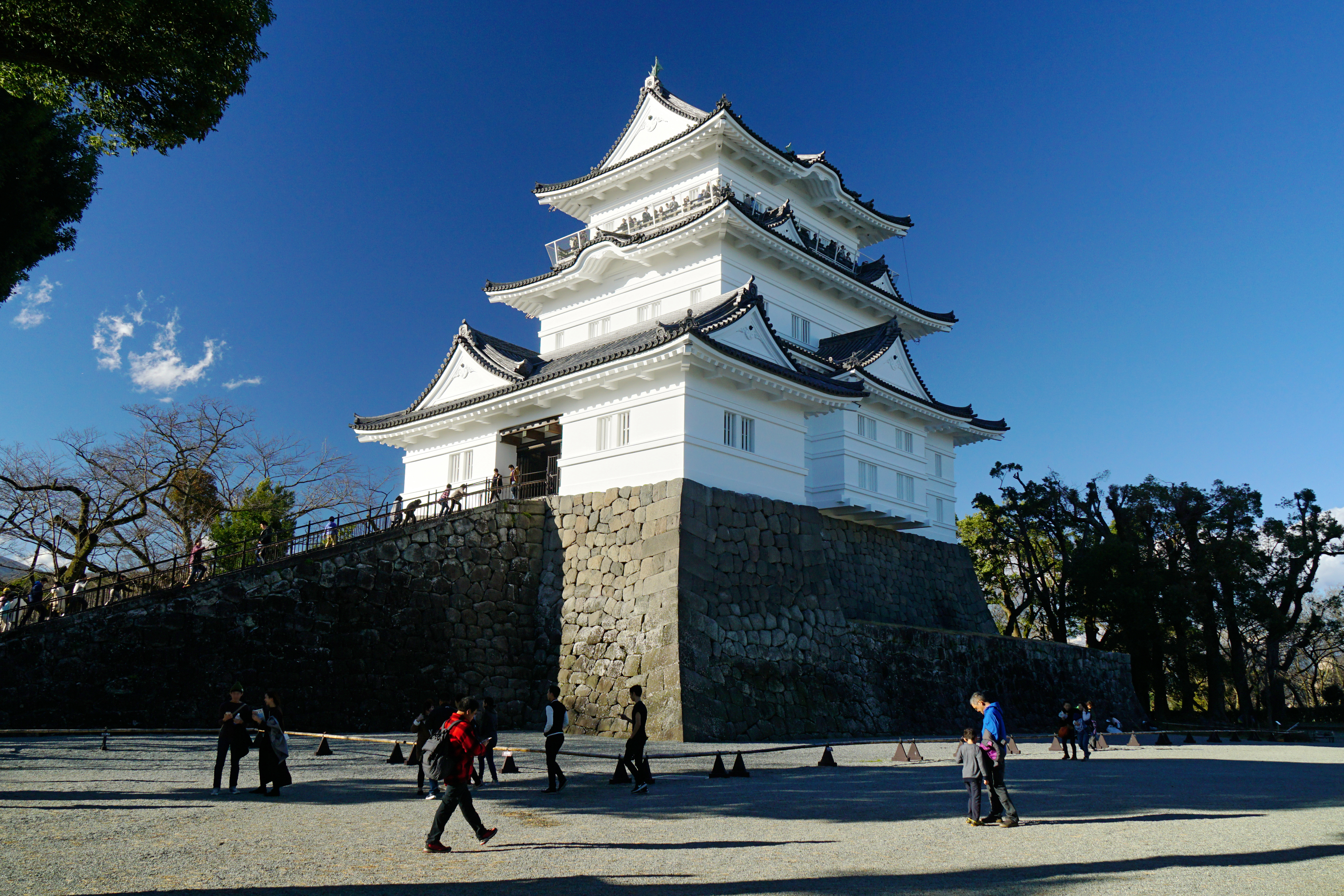
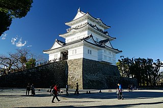
| 22:08, 23 December 2016 |  | 5,400 × 3,600 (13.29 MB) | 663highland | == {{int:filedesc}} == {{Information |Source={{own}} |Description={{en|'''Odawara Castle Keep Tower''' in Odawara, Kanagawa prefecture, Japan}} {{ja|'''小田原城'''。 所在地は神奈川県小... |
File usage
The following pages on the English Wikipedia use this file (pages on other projects are not listed):
Global file usage
The following other wikis use this file:
- Usage on ar.wikipedia.org
- Usage on azb.wikipedia.org
- Usage on az.wikipedia.org
- Usage on cs.wikipedia.org
- Usage on de.wikipedia.org
- Usage on el.wikipedia.org
- Usage on es.wikipedia.org
- Usage on eu.wikipedia.org
- Usage on fa.wikipedia.org
- Usage on fi.wikipedia.org
- Usage on fr.wikipedia.org
- Usage on id.wikipedia.org
- Usage on it.wikipedia.org
- Usage on ja.wikipedia.org
- Usage on ko.wikipedia.org
- Usage on mk.wikipedia.org
- Usage on ml.wikipedia.org
- Usage on nl.wikipedia.org
- Usage on no.wikipedia.org
- Usage on pt.wikipedia.org
- Usage on ru.wikipedia.org
- Usage on simple.wikipedia.org
- Usage on sk.wikipedia.org
- Usage on sr.wikipedia.org
View more global usage of this file.