

Size of this preview: 800 × 495 pixels. Other resolutions: 320 × 198 pixels | 640 × 396 pixels | 1,024 × 633 pixels | 1,280 × 791 pixels | 2,700 × 1,669 pixels.
Original file (2,700 × 1,669 pixels, file size: 2.24 MB, MIME type: image/png)
| Description |
|
||||||||||||||
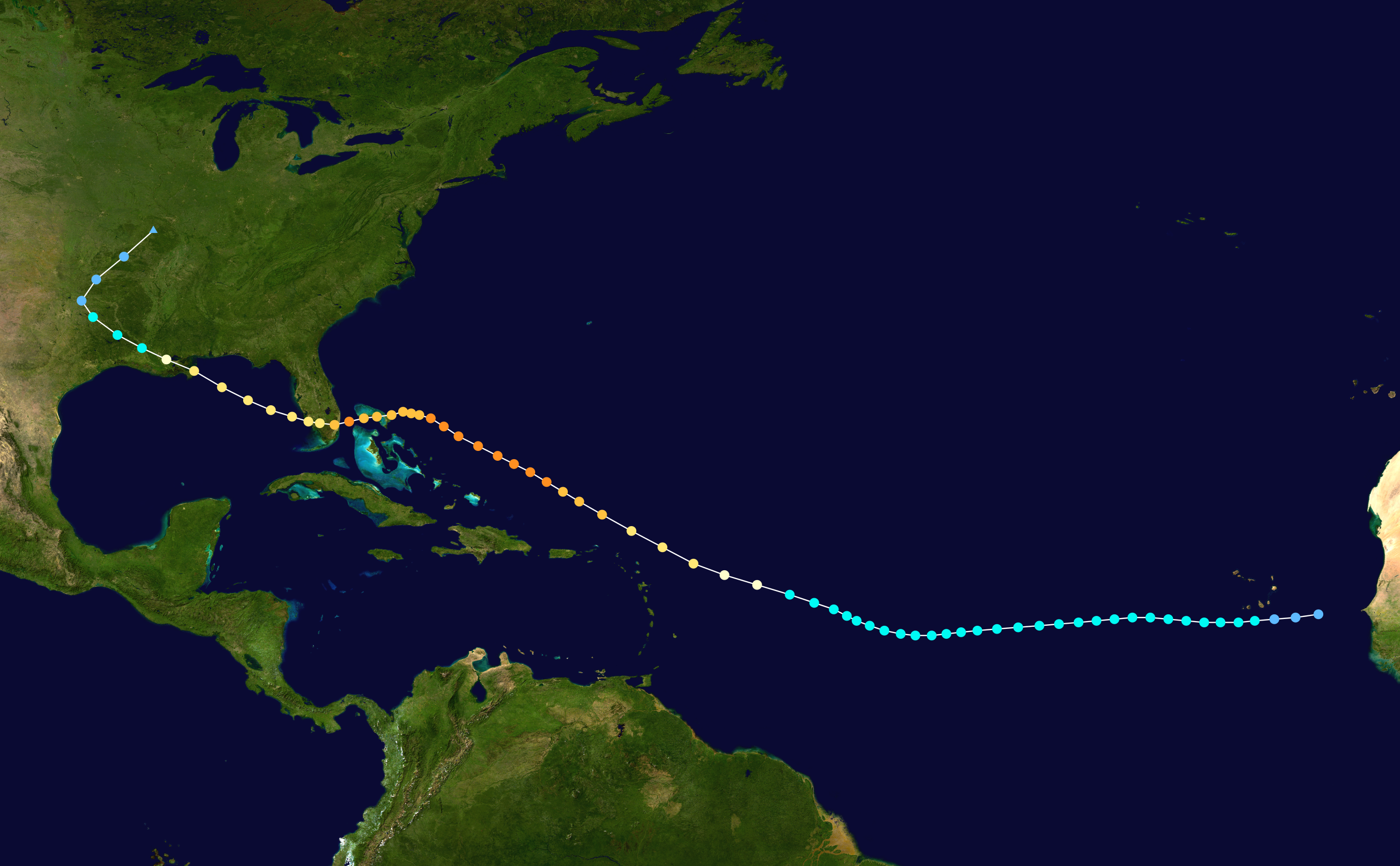
| Source | Created using Wikipedia:WikiProject Tropical cyclones/Tracks. The background image is from NASA. Tracking data from the National Hurricane Center.[1] | ||||||||||||||
| Author | See file upload history for details. | ||||||||||||||
| I, the copyright holder of this work, release this work into the public domain. This applies worldwide. In some countries this may not be legally possible; if so: I grant anyone the right to use this work for any purpose, without any conditions, unless such conditions are required by law. |
File history
Click on a date/time to view the file as it appeared at that time.
| Date/Time | Thumbnail | Dimensions | User | Comment | |
|---|---|---|---|---|---|
| current | 21:46, 25 March 2014 | | 2,700 × 1,669 (2.24 MB) | Supportstorm | 2014 HURDAT update |
| 11:58, 15 July 2006 |  | 1,024 × 633 (378 KB) | Nilfanion | ||
| 04:42, 14 November 2005 |  | 1,024 × 633 (403 KB) | Jdorje~commonswiki | {{Hurricane auto track map|1947 Fort Lauderdale hurricane}} | |
| 04:08, 4 November 2005 |  | 1,024 × 633 (403 KB) | Jdorje~commonswiki | {{Hurricane auto track map|1947 Fort Lauderdale hurricane}} |
File usage
The following pages on the English Wikipedia use this file (pages on other projects are not listed):