

Size of this preview: 800 × 521 pixels. Other resolutions: 320 × 208 pixels | 640 × 417 pixels | 1,024 × 667 pixels | 1,337 × 871 pixels.
Original file (1,337 × 871 pixels, file size: 469 KB, MIME type: image/jpeg)
Summary
| Description |
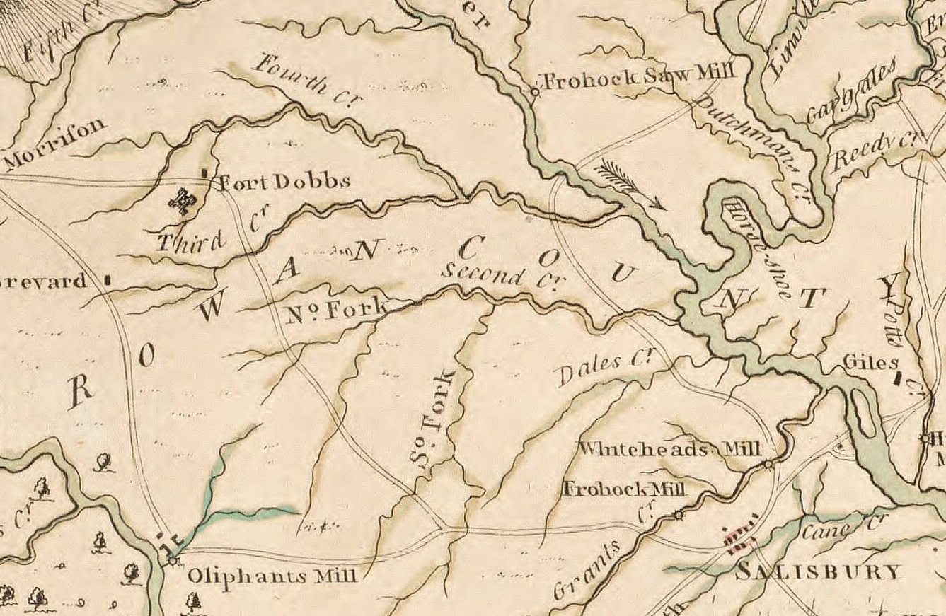
An excerpt of John Collet's 1770 map of North Carolina depicting the Carolina back-country, including Charlotte, Salisbury, Salem, and Fort Dobbs. |
|---|---|
| Source |
Original publication: London, 1770 |
| Date |
1770 |
| Author |
John Collet, J. Bayly, S. Hooper |
| Permission (Reusing this file) |
See below.
|
Licensing
File history
Click on a date/time to view the file as it appeared at that time.
| Date/Time | Thumbnail | Dimensions | User | Comment | |
|---|---|---|---|---|---|
| current | 14:36, 31 December 2012 | | 1,337 × 871 (469 KB) | Cdtew (talk | contribs) | Smaller excerpt. |
| 14:13, 31 December 2012 |  | 2,907 × 3,220 (3.5 MB) | Cdtew (talk | contribs) | Added arrow to show location of Fort Dobbs. | |
| 14:08, 31 December 2012 |  | 2,907 × 3,220 (2.39 MB) | Cdtew (talk | contribs) | Uploading an old public-domain work using File Upload Wizard |
You cannot overwrite this file.
File usage
The following pages on the English Wikipedia use this file (pages on other projects are not listed):