


Size of this preview: 800 × 600 pixels. Other resolutions: 320 × 240 pixels | 640 × 480 pixels | 1,024 × 768 pixels | 1,280 × 960 pixels | 2,272 × 1,704 pixels.
Original file (2,272 × 1,704 pixels, file size: 1.97 MB, MIME type: image/jpeg)
Summary
|
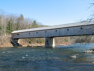
This is an image of a place or building that is listed on the National Register of Historic Places in the United States of America. Its reference number is 73000207. |
| Description |
English: Covered bridge, Dummerston, Vermont |
| Date | |
| Source | Covered Bridge, Dummerston, Vermont |
| Author | Jared and Corin, upload by Herrick |
| Camera location | | View this and other nearby images on: OpenStreetMap |
|---|
Licensing
This file is licensed under the Creative Commons Attribution-Share Alike 2.0 Generic license.
- You are free:
- to share – to copy, distribute and transmit the work
- to remix – to adapt the work
- Under the following conditions:
- attribution – You must give appropriate credit, provide a link to the license, and indicate if changes were made. You may do so in any reasonable manner, but not in any way that suggests the licensor endorses you or your use.
- share alike – If you remix, transform, or build upon the material, you must distribute your contributions under the same or compatible license as the original.
| This image was originally posted to Flickr by redjar at https://www.flickr.com/photos/87434398@N00/113861485. It was reviewed on 1 April 2008 by FlickreviewR and was confirmed to be licensed under the terms of the cc-by-sa-2.0. |
File history
Click on a date/time to view the file as it appeared at that time.
| Date/Time | Thumbnail | Dimensions | User | Comment | |
|---|---|---|---|---|---|
| current | 11:13, 22 January 2008 | | 2,272 × 1,704 (1.97 MB) | Herrick~commonswiki | {{Information |Description= {{en|Covered bridge, Dummerston, Vermont}} |Source=[http://www.flickr.com/photos/87434398@N00/113861485/ Covered Bridge, Dummerston, Vermont] |Date=April 12, 2003 at 15:17 |Author=[http://www.flickr.com/people/87434398@N00 Jare |
File usage
The following pages on the English Wikipedia use this file (pages on other projects are not listed):
Global file usage
The following other wikis use this file:
- Usage on de.wikipedia.org