

Size of this preview: 800 × 565 pixels. Other resolutions: 320 × 226 pixels | 640 × 452 pixels | 1,024 × 724 pixels | 1,280 × 904 pixels | 2,560 × 1,809 pixels | 4,571 × 3,230 pixels.
Original file (4,571 × 3,230 pixels, file size: 1.61 MB, MIME type: image/jpeg)
|
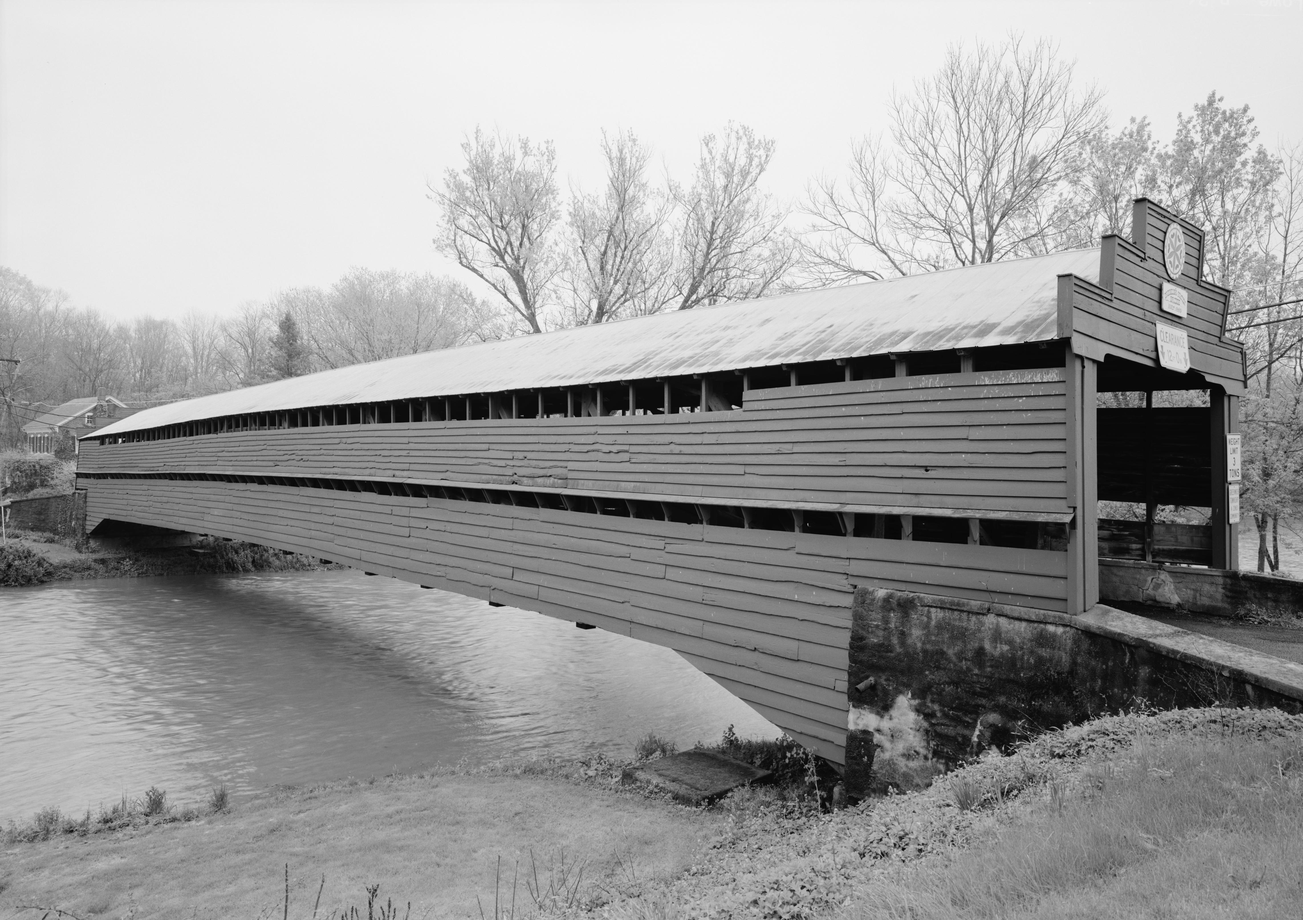
This is an image of a place or building that is listed on the National Register of Historic Places in the United States of America. Its reference number is 81000530. |
Summary
| Description |
English: Dreibelbis Station Bridge, Spanning Maiden Creek, Balthaser Road (TR 745), Lenhartsville vicinity, (Berks County, Pennsylvania) |
|||||||||||||||||||||||
| Date | between 2002 and 2005 | |||||||||||||||||||||||
| Source |
Historic American Engineering Record, Library of Congress, Call number HAER PA-587-2
|
|||||||||||||||||||||||
| Author |
|
|||||||||||||||||||||||

.jpg)
| Object location | | View this and other nearby images on: OpenStreetMap |
|---|
,_Lenhartsville_vicinity,_(Berks_County,_Pennsylvania).jpg¶ms=040.554722_N_-075.880000_E_globe:Earth_class:object_region:US_type:landmark_scale:1500_&language=en)
Licensing
| This image or media file contains material based on a work of a National Park Service employee, created as part of that person's official duties. As a work of the U.S. federal government, such work is in the public domain in the United States. See the NPS website and NPS copyright policy for more information. |
|
File history
Click on a date/time to view the file as it appeared at that time.
| Date/Time | Thumbnail | Dimensions | User | Comment | |
|---|---|---|---|---|---|
| current | 16:17, 6 March 2010 | | 4,571 × 3,230 (1.61 MB) | Martin H. | full size, cropped |
| 18:03, 19 January 2010 |  | 899 × 631 (129 KB) | KudzuVine | Dreibelbis Station Bridge, Spanning Maiden Creek, Balthaser Road (TR 745), Lenhartsville vicinity, (Berks County, Pennsylvania) cropped - recropped to fix mistake {{PD-PD-USGov-NPS-HAER|PA-587-2}} source + http://memory.loc.gov/pnp/habshaer/pa/pa3900/pa39 | |
| 17:55, 19 January 2010 |  | 899 × 642 (129 KB) | KudzuVine | {{Information |Description={{en|1=Dreibelbis Station Bridge, Spanning Maiden Creek, Balthaser Road (TR 745), Lenhartsville vicinity, (Berks County, Pennsylvania) cropped {{PD-USGov-NPS-HAER|PA-587-2}}}} |Source=http://memory.loc.gov/pnp/habshaer/pa/pa3900 |
File usage
The following pages on the English Wikipedia use this file (pages on other projects are not listed):
Global file usage
The following other wikis use this file:
- Usage on www.wikidata.org
,_Lenhartsville_vicinity,_(Berks_County,_Pennsylvania).jpg)