


Size of this preview: 800 × 532 pixels. Other resolutions: 320 × 213 pixels | 640 × 426 pixels | 1,024 × 681 pixels | 1,280 × 852 pixels | 2,560 × 1,704 pixels | 3,468 × 2,308 pixels.
Original file (3,468 × 2,308 pixels, file size: 2.17 MB, MIME type: image/jpeg)
|
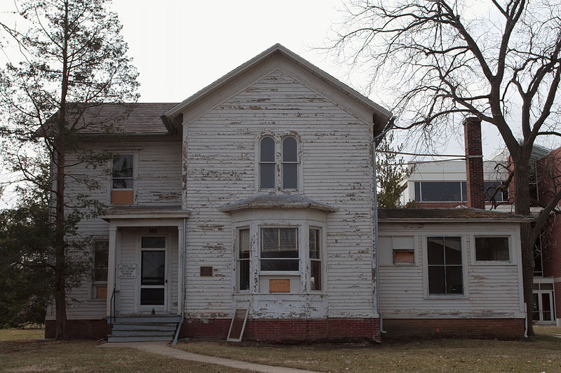
This is an image of a place or building that is listed on the National Register of Historic Places in the United States of America. Its reference number is 89001728. |
| Description |
Urbana, IL Farm House ** (added 1989 - Building - #89001728) Also known as Mumford House 1403 E. Lorado Taft Dr., Urbana Historic Significance: Person, Architecture/Engineering Architect, builder, or engineer: Searfoss,J.S. Architectural Style: Gothic Historic Person: Multiple Significant Year: 1870 Area of Significance: Architecture, Education Period of Significance: 1850-1874, 1875-1899 Owner: State Historic Function: Domestic Historic Sub-function: Single Dwelling Current Function: Education Current Sub-function: College |
||
| Date | |||
| Source | Own work | ||
| Author | Dori | ||
| Permission (Reusing this file) |
I, the copyright holder of this work, hereby publish it under the following licenses:
This file is licensed under the Creative Commons Attribution-Share Alike 3.0 United States license.
 You may select the license of your choice. |
||
| Other versions |
 |

| Camera location | | View this and other nearby images on: OpenStreetMap |
|---|
File history
Click on a date/time to view the file as it appeared at that time.
| Date/Time | Thumbnail | Dimensions | User | Comment | |
|---|---|---|---|---|---|
| current | 18:51, 23 March 2008 | | 3,468 × 2,308 (2.17 MB) | DoriBot | {{Information |Description=Urbana, IL |Source=Own work |Date=2008-03-23 |Author=Dori |Permission={{self|GFDL|cc-by-sa-3.0-us}} |other_versions= }} Category:Photographs by Dori Category:Urbana, Illinois [[Category:Registered Hi |
File usage
The following pages on the English Wikipedia use this file (pages on other projects are not listed):
Global file usage
The following other wikis use this file:
- Usage on de.wikipedia.org