


Size of this preview: 800 × 600 pixels. Other resolutions: 320 × 240 pixels | 640 × 480 pixels | 1,024 × 768 pixels | 1,280 × 960 pixels | 2,272 × 1,704 pixels.
Original file (2,272 × 1,704 pixels, file size: 635 KB, MIME type: image/jpeg)
|
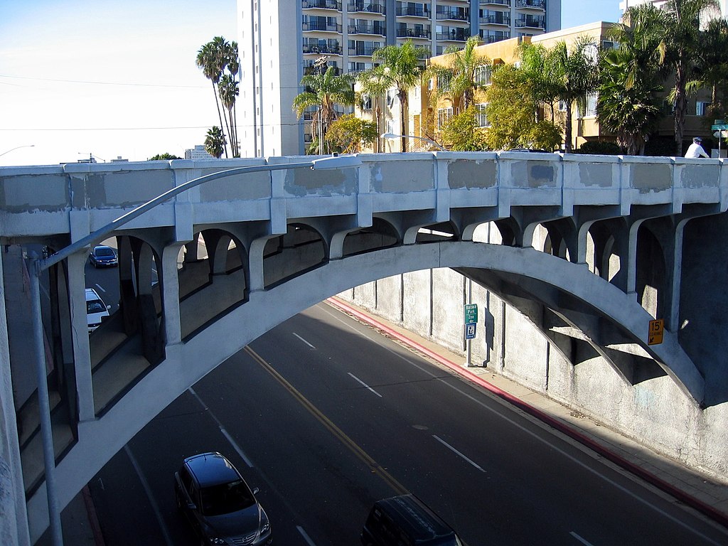
This is an image of a place or building that is listed on the National Register of Historic Places in the United States of America. Its reference number is 99000158. |
| Description | From the North Park Historical Society, "In 1907, the high ridge of Georgia Street was cut and bridged at University Avenue (the old La Mesa Road). This allowed the streetcar line to be extended eastward from Hillcrest to Fairmont Avenue, and opened North Park to suburban development. The first Georgia Street Bridge was a redwood truss bridge. But that early bridge was replaced in 1914 by the masterwork in reinforced concrete that still stands today. The columns and spandrel arches reflect the Mission Revival style. The bridge is a designated local, state and national historic landmark." " This is a 1936 image of the bridge and this is a timeline of bridges in Uptown San Diego. | ||
| Date | |||
| Source | originally posted to Flickr as Georgia Street Bridge, San Diego | ||
| Author | Eli Pousson | ||
| Permission (Reusing this file) |
This file is licensed under the Creative Commons Attribution-Share Alike 2.0 Generic license.
|
| Object location | | View this and other nearby images on: OpenStreetMap |
|---|
File history
Click on a date/time to view the file as it appeared at that time.
| Date/Time | Thumbnail | Dimensions | User | Comment | |
|---|---|---|---|---|---|
| current | 03:54, 25 January 2010 | | 2,272 × 1,704 (635 KB) | Flickr upload bot | Uploaded from http://flickr.com/photo/59179756@N00/4243547882 using Flickr upload bot |
File usage
The following pages on the English Wikipedia use this file (pages on other projects are not listed):
Global file usage
The following other wikis use this file:
- Usage on de.wikipedia.org
- Usage on es.wikipedia.org
- Usage on fr.wikipedia.org
- Usage on www.wikidata.org