

Size of this preview: 372 × 599 pixels. Other resolutions: 149 × 240 pixels | 500 × 805 pixels.
Original file (500 × 805 pixels, file size: 33 KB, MIME type: image/png)
Summary
| Description |
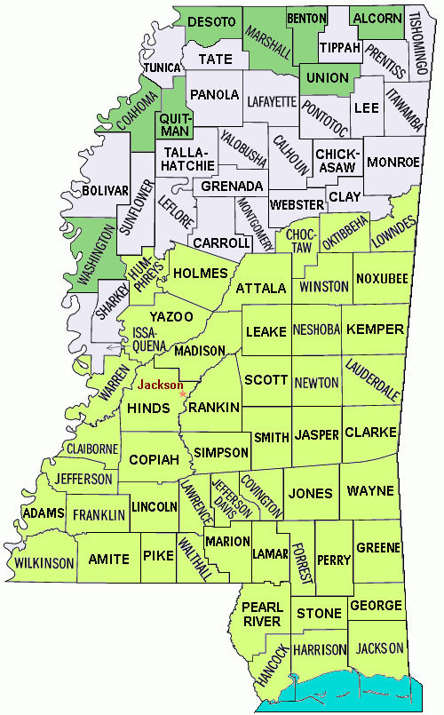
English: Hurricane Katrina disaster areas: Map of the state of Mississippi showing borders and names of the counties, with disaster areas from Hurricane Katrina shaded: all counties in Mississippi were declared disaster areas on 10/27/2005, with 49 counties for full Federal assistance (FEMA). The file is in JPEG format for rapid display, due to auto-resizing smaller.Source (Wikipedia): :Image:Mississippi counties map.png (with 49 counties shaded, converted to JPEG format, with white background trimmed).Variations::* GIF map with flood areas: :Image:Mississippi counties map Katrina flood.gif.:* JPEG format of disaster area: :Image:Mississippi counties map Katrina disaster area.jpg.:* JPEG all counties, 280-pixel width: :Image:Mississippi counties map 280px.jpg.:* PNG-format all counties, with wide background: :Image:Mississippi counties map.png.The PNG crusade bot automatically converted this image to the more efficient PNG format. The image was previously uploaded as "Mississippi counties map Katrina disaster area.gif".04:56:03, 4 March 2007 . . Wikid77 (Talk |
| Date | 25 March 2007 (original upload date) |
| Source | |
| Author |
Licensing
This image or file is a work of a United States Census Bureau employee, taken or made as part of that person's official duties. As a work of the U.S. federal government, the image is in the public domain.
|
 |
Original upload log
Transferred from en.wikipedia to Commons by SreeBot.
The original description page was here. All following user names refer to en.wikipedia.
Upload date | User | Bytes | Dimensions | Comment
- 2007-03-25 04:16 (UTC) | PNG crusade bot | 34179 (bytes) | 500×805 | [[Hurricane Katrina]] disaster areas: Map of the state of [[Mississippi]] showing borders and names of the counties, with disaster areas from [[Hurricane Katrina]] shaded: all counties in Mississippi were declared disaster areas on 10/27/2005,
File history
Click on a date/time to view the file as it appeared at that time.
| Date/Time | Thumbnail | Dimensions | User | Comment | |
|---|---|---|---|---|---|
| current | 10:17, 29 August 2011 | | 500 × 805 (33 KB) | SreeBot |
File usage
The following pages on the English Wikipedia use this file (pages on other projects are not listed):