


Size of this preview: 800 × 535 pixels. Other resolutions: 320 × 214 pixels | 640 × 428 pixels | 1,024 × 685 pixels | 1,280 × 856 pixels | 1,596 × 1,067 pixels.
Original file (1,596 × 1,067 pixels, file size: 61 KB, MIME type: image/png)
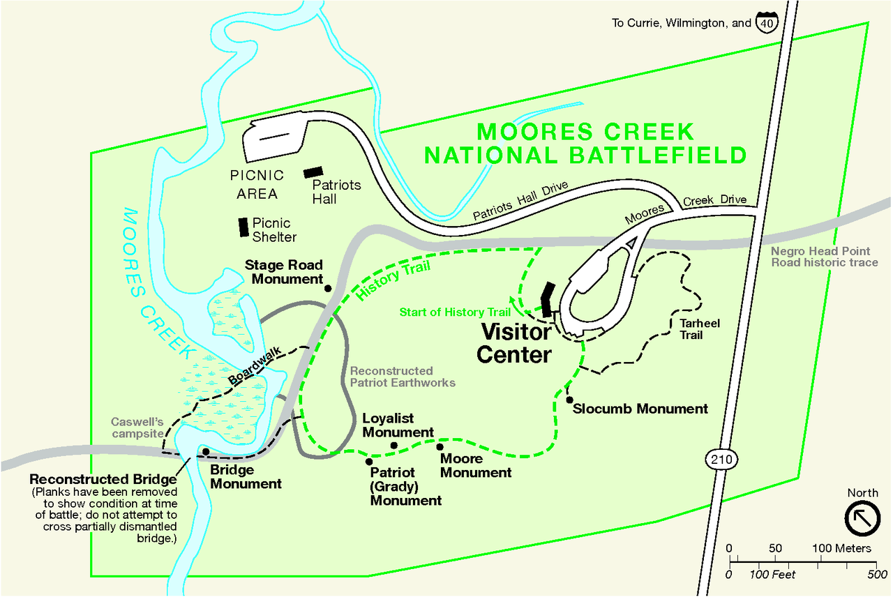
| Description | Map of Moores Creek National Battlefield, North Carolina, USA | |||
| Source | official website: http://www.nps.gov/mocr | |||
| Author | NPS map | |||
| Permission (Reusing this file) |
|
File history
Click on a date/time to view the file as it appeared at that time.
| Date/Time | Thumbnail | Dimensions | User | Comment | |
|---|---|---|---|---|---|
| current | 14:01, 21 February 2009 | | 1,596 × 1,067 (61 KB) | H-stt | {{Information |Description= Map of Moores Creek National Battlefield, North Carolina, USA |Source= official website: http://www.nps.gov/mocr |Date= |Author= NPS map |Permission= {{PD-USGov-NPS}} |other_versions= }} [[Category:Battles of the American Revo |
File usage
The following pages on the English Wikipedia use this file (pages on other projects are not listed):
Global file usage
The following other wikis use this file:
- Usage on de.wikipedia.org
- Usage on www.wikidata.org