


No higher resolution available.
NPS_hot-springs-regional-map.gif (696 × 547 pixels, file size: 56 KB, MIME type: image/gif, 0.1 s)
Summary
| Description |
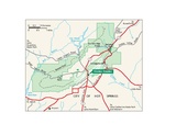
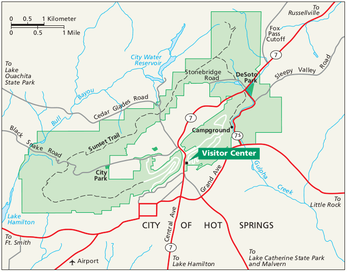
English: Regional map of Hot Springs that shows the roads and highways leading into and around the park from surrounding Arkansas. |
| Date | |
| Source | U.S. National Park Service (http://npmaps.com/wp-content/uploads/hot-springs-regional-map.gif) |
| Author | U.S. National Park Service, restoration/cleanup by Matt Holly |
| Other versions |
 |
Licensing
| This image or media file contains material based on a work of a National Park Service employee, created as part of that person's official duties. As a work of the U.S. federal government, such work is in the public domain in the United States. See the NPS website and NPS copyright policy for more information. |
File history
Click on a date/time to view the file as it appeared at that time.
| Date/Time | Thumbnail | Dimensions | User | Comment | |
|---|---|---|---|---|---|
| current | 23:46, 16 May 2017 | | 696 × 547 (56 KB) | RKBot | =={{int:filedesc}}== {{Information |description= {{en|1=Regional map of Hot Springs that shows the roads and highways leading into and around the park from surrounding Arkansas.}} |date= 2015-07-30 |source= U.S. National Park Service (http://npmaps.com... |
File usage
The following pages on the English Wikipedia use this file (pages on other projects are not listed):