


Size of this preview: 800 × 514 pixels. Other resolutions: 320 × 206 pixels | 640 × 411 pixels | 982 × 631 pixels.
Original file (982 × 631 pixels, file size: 140 KB, MIME type: image/jpeg)
|
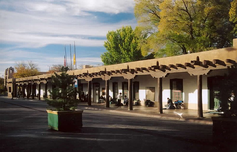
This is an image of a place or building that is listed on the National Register of Historic Places in the United States of America. Its reference number is 66000489. |
Transferred from en.wikipedia to Commons by Maksim.
The original description page was here. All following user names refer to en.wikipedia.
wikipedia exclusive photo by Einar Einarsson Kvaran

|
Permission is granted to copy, distribute and/or modify this document under the terms of the GNU Free Documentation License, Version 1.2 or any later version published by the Free Software Foundation; with no Invariant Sections, no Front-Cover Texts, and no Back-Cover Texts. A copy of the license is included in the section entitled GNU Free Documentation License. |
| This file is licensed under the Creative Commons Attribution-Share Alike 3.0 Unported license. | ||
| ||
| This licensing tag was added to this file as part of the GFDL licensing update. |
| date/time | username | edit summary |
|---|---|---|
| 00:29, 2 November 2004 | en:User:Carptrash | (wikipedia exclusive photo by Einar Einarsson Kvaran {{GFDL}} <a href="/wiki/Santa_Fe" title="Santa Fe">Santa Fe</a>) |
Original upload log
Legend: (cur) = this is the current file, (del) = delete this old version, (rev) = revert to this old version.
Click on date to download the file or see the image uploaded on that date.
- (del) (cur) 00:29, 2 November 2004 . . en:User:Carptrash Carptrash ( en:User_talk:Carptrash Talk) . . 982x631 (143128 bytes) (wikipedia exclusive photo by Einar Einarsson Kvaran { { GFDL } } en:Santa_Fe Santa Fe)
| Object location | | View this and other nearby images on: OpenStreetMap |
|---|
File history
Click on a date/time to view the file as it appeared at that time.
| Date/Time | Thumbnail | Dimensions | User | Comment | |
|---|---|---|---|---|---|
| current | 10:20, 12 March 2006 | | 982 × 631 (140 KB) | Maksim | La bildo estas kopiita de wikipedia:en. La originala priskribo estas: wikipedia exclusive photo by Einar Einarsson Kvaran {{GFDL}} Santa Fe {| border="1" ! date/time || username || edit summary |---- | 00:29, 2 November 2004 || [[:en:User:Carptrash] |
File usage
The following pages on the English Wikipedia use this file (pages on other projects are not listed):
- Charlotte and Dick Green
- Index of New Mexico–related articles
- List of National Historic Landmarks in New Mexico
- List of museums in New Mexico
- List of oldest buildings in the Americas
- List of palaces
- List of the oldest buildings in New Mexico
- Maria Chabot
- National Register of Historic Places listings in Santa Fe County, New Mexico
- New Mexico State Capitol
- Palace of the Governors
Global file usage
The following other wikis use this file:
- Usage on de.wikipedia.org
- Usage on en.wikivoyage.org
- Usage on eo.wikipedia.org
- Usage on es.wikipedia.org
- Usage on es.wikivoyage.org
- Usage on fr.wikipedia.org
- Usage on hu.wikipedia.org
- Usage on it.wikipedia.org
- Usage on it.wikivoyage.org
- Usage on ja.wikipedia.org
- Usage on lv.wikipedia.org
- Usage on nl.wikipedia.org
- Usage on pt.wikipedia.org
- Usage on ru.wikipedia.org
- Usage on ur.wikipedia.org
- Usage on www.wikidata.org