

Size of this preview: 789 × 600 pixels. Other resolutions: 316 × 240 pixels | 632 × 480 pixels | 1,010 × 768 pixels | 1,143 × 869 pixels.
Original file (1,143 × 869 pixels, file size: 134 KB, MIME type: image/png)
Summary
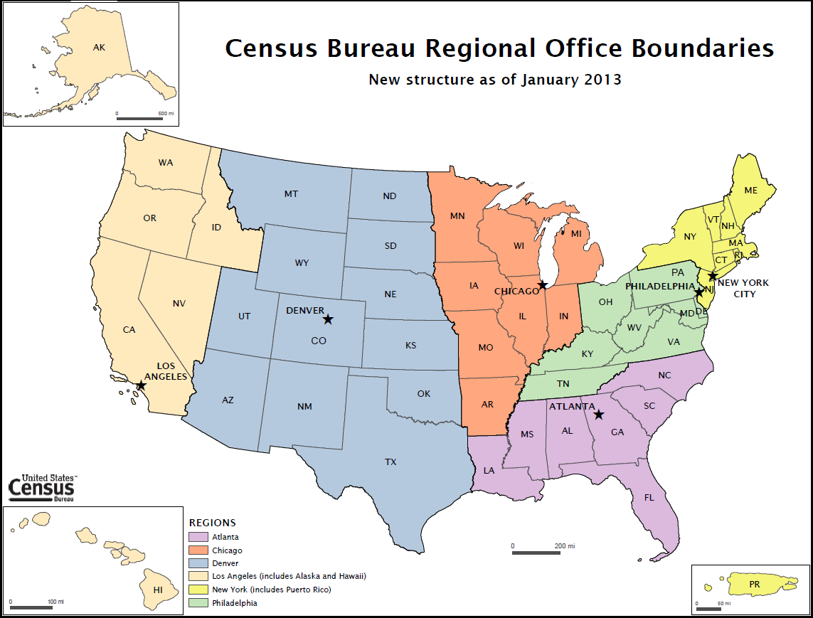
| Description | New Regional Office Map |
| Source | https://www.census.gov\/newsroom/pdf/new_ro_map_final2.pdf |
| Author | US Bureau of the Census |
| Other versions |

|
File:New Regional Offices.svg is a vector version of this file. It should be used in place of this PNG file when not inferior.
File:New Regional Offices.png → File:New Regional Offices.svg
For more information, see Help:SVG. |
 |
Licensing
This image or file is a work of a United States Census Bureau employee, taken or made as part of that person's official duties. As a work of the U.S. federal government, the image is in the public domain.
|
 |
File history
Click on a date/time to view the file as it appeared at that time.
| Date/Time | Thumbnail | Dimensions | User | Comment | |
|---|---|---|---|---|---|
| current | 23:48, 21 June 2012 | | 1,143 × 869 (134 KB) | Aephyx | {{Information |Description=New Regional Office Map |Source=http://www.census.gov/newsroom/pdf/new_ro_map_final2.pdf |Author=US Bureau of the Census |other_versions=PDF }} {{PD-USGov-DOC-Census}} |
File usage
The following pages on the English Wikipedia use this file (pages on other projects are not listed):