


Size of this preview: 762 × 600 pixels. Other resolutions: 305 × 240 pixels | 610 × 480 pixels | 958 × 754 pixels.
Original file (958 × 754 pixels, file size: 189 KB, MIME type: image/jpeg)
|
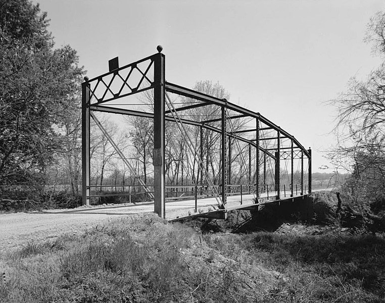
This is an image of a place or building that is listed on the National Register of Historic Places in the United States of America. Its reference number is 89002172. |
| Camera location | | View this and other nearby images on: OpenStreetMap |
|---|
| Description |
English: Western side of the Onion Creek Bridge, a Parker through truss bridge located south of Coffeyville, Montgomery County, Kansas, United States. Built in 1911, the bridge was added to the National Register of Historic Places on 4 January 1990. |
|||||
| Date | ||||||
| Source | This image, hosted on the Library of Congress website | |||||
| Author | Unknown author | |||||
| Permission (Reusing this file) |
|

%20of%20building%3cbr%3eHABS%20KS-55-A-3&displayProfile=0)
File history
Click on a date/time to view the file as it appeared at that time.
| Date/Time | Thumbnail | Dimensions | User | Comment | |
|---|---|---|---|---|---|
| current | 22:51, 15 February 2009 | | 958 × 754 (189 KB) | Hohum | Cropped border, levels. |
| 22:48, 15 February 2009 |  | 1,024 × 814 (163 KB) | Nyttend | {{Information |Description={{en|Western side of the {{w|Onion Creek Bridge}}, a {{w|Parker truss|Parker through truss bridge}} located south of {{w|Coffeyville, Kansas|Coffeyville}}, {{w|Montgomery County, Kansas|Montgomery County}}, {{w|Kansas}}, {{w|Uni |
File usage
The following pages on the English Wikipedia use this file (pages on other projects are not listed):
Global file usage
The following other wikis use this file:
- Usage on de.wikipedia.org
- Usage on www.wikidata.org