


Size of this preview: 800 × 450 pixels. Other resolutions: 320 × 180 pixels | 640 × 360 pixels | 1,024 × 576 pixels | 1,280 × 720 pixels | 2,816 × 1,584 pixels.
Original file (2,816 × 1,584 pixels, file size: 717 KB, MIME type: image/jpeg)
|
This is an image of a place or building that is listed on the National Register of Historic Places in the United States of America. Its reference number is 78001151. |
| Camera location | | View this and other nearby images on: OpenStreetMap |
|---|
| Description |
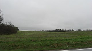
English: Looking southward from Illinois Route 146 midway between Rosiclare and Elizabethtown in Stone Church Precinct, Hardin County, Illinois, United States. In the distance is the Orr-Herl Village Site; an important archaeological site, it is listed on the National Register of Historic Places. |
||
| Date | Taken on 11 April 2013 | ||
| Source | Own work | ||
| Author | Nyttend | ||
| Permission (Reusing this file) |
|
File history
Click on a date/time to view the file as it appeared at that time.
| Date/Time | Thumbnail | Dimensions | User | Comment | |
|---|---|---|---|---|---|
| current | 02:04, 19 April 2013 | | 2,816 × 1,584 (717 KB) | Nyttend | {{NRHP|78001151}} {{Location|37|26|39|N|88|19|42|W}} {{Information |Description={{en|Looking southward from {{w|Illinois Route 146}} misway between {{w|Rosiclare, Illinois|Rosiclare}} and {{w|Elizabethtown, Illinois|Elizabethtown}} in {{w|Stone Church ... |
File usage
The following pages on the English Wikipedia use this file (pages on other projects are not listed):
Global file usage
The following other wikis use this file:
- Usage on de.wikipedia.org
- Usage on www.wikidata.org