


Size of this preview: 662 × 600 pixels. Other resolutions: 265 × 240 pixels | 530 × 480 pixels | 848 × 768 pixels | 1,236 × 1,120 pixels.
Original file (1,236 × 1,120 pixels, file size: 223 KB, MIME type: image/jpeg)
| Description |
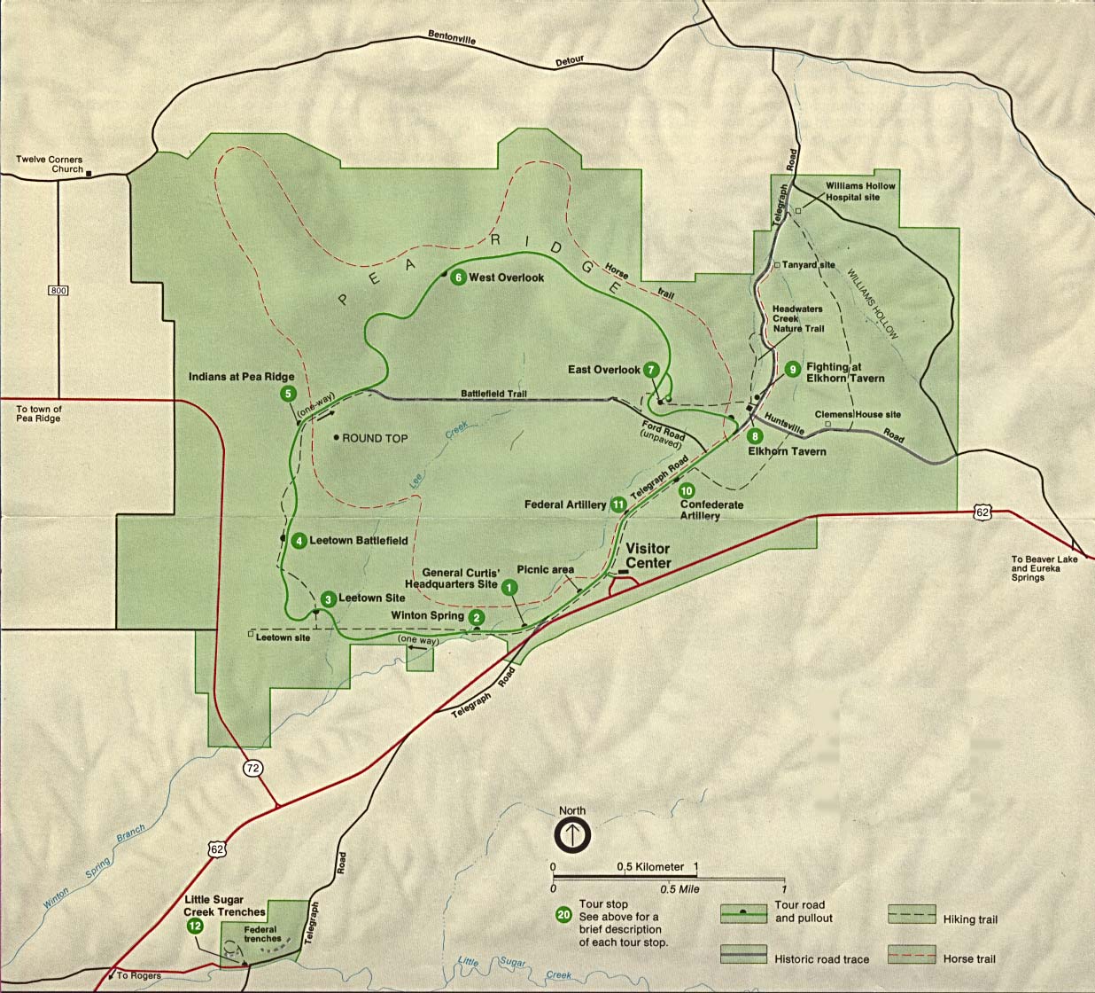
English: Pea Ridge National Military Park park map, originally listed and attributed to the US National Park Service at http://www.lib.utexas.edu/maps/arkansas.html |
|||
| Source | http://www.lib.utexas.edu/maps/national_parks/pea_ridge_map.jpg | |||
| Author | US National Park Service | |||
| Permission (Reusing this file) |
|
File history
Click on a date/time to view the file as it appeared at that time.
| Date/Time | Thumbnail | Dimensions | User | Comment | |
|---|---|---|---|---|---|
| current | 15:37, 9 December 2017 | | 1,236 × 1,120 (223 KB) | MarginalCost | {{Information |Description ={{en|1=Pea Ridge National Military Park park map, originally listed and attributed to the US National Park Service at http://www.lib.utexas.edu/maps/arkansas.html}} |Source =http://www.lib.utexas.edu/maps/national... |
File usage
The following pages on the English Wikipedia use this file (pages on other projects are not listed):
Global file usage
The following other wikis use this file:
- Usage on zh.wikipedia.org