


Size of this preview: 800 × 450 pixels. Other resolutions: 320 × 180 pixels | 640 × 360 pixels | 1,024 × 576 pixels | 1,280 × 720 pixels | 2,816 × 1,584 pixels.
Original file (2,816 × 1,584 pixels, file size: 1.87 MB, MIME type: image/jpeg)
|
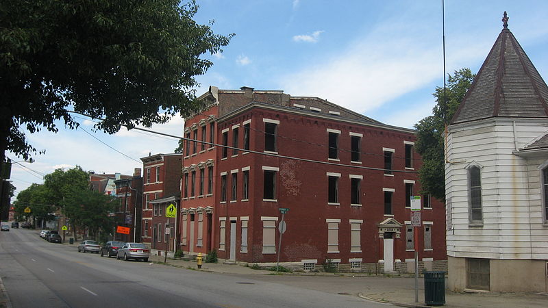
This is an image of a place or building that is listed on the National Register of Historic Places in the United States of America. Its reference number is 88002536. |
| Camera location | | View this and other nearby images on: OpenStreetMap |
|---|
| Description |
English: Buildings on the eastern side of State Avenue (State Route 264) on the northern side of the Storrs Street intersection (plus the State Avenue Methodist Church on the southern side) in the Lower Price Hill neighborhood of Cincinnati, Ohio, United States. This neighborhood is part of the Lower Price Hill Historic District, a historic district that is listed on the National Register of Historic Places. |
||
| Date | Taken on 23 June 2012 | ||
| Source | Own work | ||
| Author | Nyttend | ||
| Permission (Reusing this file) |
|
File history
Click on a date/time to view the file as it appeared at that time.
| Date/Time | Thumbnail | Dimensions | User | Comment | |
|---|---|---|---|---|---|
| current | 13:07, 9 July 2012 | | 2,816 × 1,584 (1.87 MB) | Nyttend | {{NRHP|88002536}} {{Location|39|6|12|N|84|33|13|W}} {{Information |Description={{en|Buildings on the eastern side of State Avenue ({{w|Ohio State Route 264|State Route 264}}) on the northern side of the Storrs Street intersection (plus the State Avenue... |
File usage
The following pages on the English Wikipedia use this file (pages on other projects are not listed):
Global file usage
The following other wikis use this file:
- Usage on www.wikidata.org