


Size of this preview: 538 × 600 pixels. Other resolutions: 215 × 240 pixels | 431 × 480 pixels | 793 × 884 pixels.
Original file (793 × 884 pixels, file size: 161 KB, MIME type: image/png)
Summary
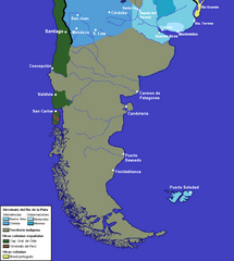
| Description | mapa del sur del virreinato.png |
| Date | |
| Source | trabajo propio sobre virreinato.png |
| Author | pruxo |
Licensing
| I, the copyright holder of this work, release this work into the public domain. This applies worldwide. In some countries this may not be legally possible; if so: I grant anyone the right to use this work for any purpose, without any conditions, unless such conditions are required by law. |
File history
Click on a date/time to view the file as it appeared at that time.
| Date/Time | Thumbnail | Dimensions | User | Comment | |
|---|---|---|---|---|---|
| current | 14:35, 16 August 2023 | | 793 × 884 (161 KB) | Janitoalevic | Jurisdicciones superpuestas en Chiloé |
| 17:27, 8 December 2022 |  | 793 × 884 (161 KB) | Janitoalevic | Límite no vigente en el año de los asentamientos | |
| 01:25, 3 June 2012 |  | 793 × 884 (180 KB) | Franco-eisenhower | ||
| 15:24, 12 May 2011 |  | 773 × 825 (42 KB) | Franco-eisenhower | Bigger font. | |
| 14:53, 12 May 2011 |  | 773 × 825 (41 KB) | Franco-eisenhower | Clearer version, no borders over indigenous territory. | |
| 14:20, 28 May 2007 |  | 310 × 341 (18 KB) | Pruxo | {{Information |Description=mapa del sur del virreinato.png |Source=trabajo propio sobre virreinato.png |Date=2007 |Author=pruxo |Permission= |other_versions= }} |
File usage
The following pages on the English Wikipedia use this file (pages on other projects are not listed):
Global file usage
The following other wikis use this file:
- Usage on es.wikipedia.org
- Usage on fr.wikipedia.org