

Size of this preview: 800 × 564 pixels. Other resolutions: 320 × 226 pixels | 640 × 451 pixels | 940 × 663 pixels.
Original file (940 × 663 pixels, file size: 72 KB, MIME type: image/jpeg)
Summary
| Description |
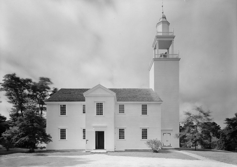
English: Photographic view from the south east of West Parish Congregational Church, State Route 19, Barnstable, Barnstable County, Massachusetts |
| Date | |
| Source | Library of Congress, Historic American Buildings Survey: MASS,1-BAR,6-1 |
| Author | Cervin Robinson |

|
This image is available from the United States Library of Congress's Prints and Photographs division
under the digital ID hhh.MA0004. This tag does not indicate the copyright status of the attached work. A normal copyright tag is still required. See Commons:Licensing.
|
Licensing

|
This file comes from the Historic American Buildings Survey (HABS), Historic American Engineering Record (HAER) or Historic American Landscapes Survey (HALS). These are programs of the National Park Service established for the purpose of documenting historic places. Records consist of measured drawings, archival photographs, and written reports.
|
| This image or media file contains material based on a work of a National Park Service employee, created as part of that person's official duties. As a work of the U.S. federal government, such work is in the public domain in the United States. See the NPS website and NPS copyright policy for more information. |
File history
Click on a date/time to view the file as it appeared at that time.
| Date/Time | Thumbnail | Dimensions | User | Comment | |
|---|---|---|---|---|---|
| current | 07:18, 2 July 2011 | | 940 × 663 (72 KB) | Cropbot | upload cropped version, operated by User:Finavon. Summary: border cropped |
| 04:40, 18 March 2010 |  | 1,024 × 732 (82 KB) | MarmadukePercy | {{Information |Description={{en|1=Photographic view from the southeast of West Parish Congregational Church, State Route 19, Barnstable, Barnstable County, Massachusetts, Historic American Buildings Survey, Library of Congress, Washington, D.C.}} |Source= |
File usage
The following pages on the English Wikipedia use this file (pages on other projects are not listed):
Global file usage
The following other wikis use this file:
- Usage on ja.wikipedia.org