


This is a list of the Pennsylvania state historical markers in Fulton County.
This is intended to be a complete list of the official state historical markers placed in Fulton County, Pennsylvania by the Pennsylvania Historical and Museum Commission (PHMC). The locations of the historical markers, as well as the latitude and longitude coordinates as provided by the PHMC's database, are included below when available. There are 11 historical markers located in Fulton County.[1]
Historical markers
| Marker title | Image | Date dedicated | Location | Marker type | Topics |
|---|---|---|---|---|---|
| Big Spring Graveyard | 
|
November 6, 1989 | U.S. 522, 2.8 miles S of McConnellsburg 38°53′24″N 78°00′59″W / 38.89005°N 78.01648°W |
Roadside | Native American |
| Burnt Cabins | 
|
June 4, 1947 | U.S. 522, .2 mile S of Burnt Cabins, county line 40°04′38″N 77°54′09″W / 40.07735°N 77.90252°W |
Roadside | Native American |
| Confederate Dead |
|
February 10, 1948 | Pa. 16, .4 mile SE of McConnellsburg 39°55′26″N 77°59′02″W / 39.92402°N 77.98381°W |
City | Civil War, Military |
| Forbes Road (Raystown Path) |
|
February 21, 1952 | U.S. 522, .2 mile SW of Burnt Cabins 40°04′39″N 77°54′06″W / 40.07744°N 77.90175°W |
Roadside | French & Indian War, Military, Transportation |
| Fort Littleton - PLAQUE |
|
July 1, 1924 | US 522, 1.2 mile from intersection at Fort Littleton 40°03′48″N 77°57′40″W / 40.06339°N 77.96109°W |
Plaque | Forts, French & Indian War, Governors, Military |
| Fort Lyttleton |
|
June 30, 1967 | U.S. 522 at Fort 40°03′48″N 77°57′39″W / 40.06341°N 77.96097°W (Missing) |
Roadside | Forts, French & Indian War, Military |
| Fulton County |
|
December 5, 1982 | County Courthouse, N. 2nd (U.S. 522) & Market Sts., McConnellsburg 39°56′02″N 77°59′55″W / 39.93399°N 77.99852°W |
City | Government & Politics, Government & Politics 19th Century |
| Gettysburg Campaign |
|
October 23, 1947 | Near intersection of Lincoln Way East and Horton St., at E end of McConnellsburg 39°55′44″N 77°59′04″W / 39.92884°N 77.98458°W |
Roadside | Civil War, Military |
| Hunter Mill |
|
October 23, 1947 | U.S. 522, 5.3 miles S of McConnellsburg at Webster Mills 39°51′35″N 78°02′09″W / 39.85966°N 78.03592°W |
Roadside | Buildings, Business & Industry, Mills |
| Last Confederate Bivouac |
|
June 4, 1947 | US 522, .6 mile S of McConnellsburg 39°55′14″N 78°00′23″W / 39.9205°N 78.00637°W |
Roadside | Civil War, Military |
| Last Confederate Bivouac - PLAQUE |
|
July 1, 1930 | US 522, 1 mile S of McConnellsburg 39°55′14″N 78°00′23″W / 39.92059°N 78.00635°W |
Plaque | Civil War, Military |
See also
- List of Pennsylvania state historical markers
- National Register of Historic Places listings in Fulton County, Pennsylvania
References
- ^ "PHMC Historical Markers Search" (Searchable database). Pennsylvania Historical and Museum Commission. Commonwealth of Pennsylvania. Retrieved 2010-07-19.
External links
Municipalities and communities of Fulton County, Pennsylvania, United States | ||
|---|---|---|
| Boroughs | 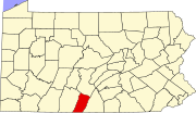 | |
| Townships | ||
| CDP | ||
| Unincorporated communities | ||
| Footnotes | ‡This populated place also has portions in an adjacent county or counties | |
