

Stratton is a statutory town in Kit Carson County, Colorado, United States. The population was 656 at the 2020 census.[5] Stratton was named in honor of the gold miner and philanthropist Winfield Scott Stratton.
Geography
Stratton is located at 39°18′11″N 102°36′15″W / 39.30306°N 102.60417°W (39.302976, -102.604272).[7]
According to the United States Census Bureau, the town has a total area of 0.5 square miles (1.3 km2), all of it land.
Climate
| Climate data for Stratton, Colorado, 1991–2020 normals, extremes 1934–2012 | |||||||||||||
|---|---|---|---|---|---|---|---|---|---|---|---|---|---|
| Month | Jan | Feb | Mar | Apr | May | Jun | Jul | Aug | Sep | Oct | Nov | Dec | Year |
| Record high °F (°C) | 77 (25) |
80 (27) |
85 (29) |
93 (34) |
99 (37) |
106 (41) |
108 (42) |
105 (41) |
101 (38) |
94 (34) |
83 (28) |
83 (28) |
108 (42) |
| Mean maximum °F (°C) | 66.3 (19.1) |
67.4 (19.7) |
78.3 (25.7) |
84.8 (29.3) |
90.3 (32.4) |
98.0 (36.7) |
101.0 (38.3) |
98.3 (36.8) |
94.6 (34.8) |
86.2 (30.1) |
75.0 (23.9) |
66.4 (19.1) |
101.5 (38.6) |
| Mean daily maximum °F (°C) | 43.0 (6.1) |
46.1 (7.8) |
56.0 (13.3) |
63.2 (17.3) |
73.2 (22.9) |
84.2 (29.0) |
89.6 (32.0) |
87.5 (30.8) |
79.7 (26.5) |
66.7 (19.3) |
52.6 (11.4) |
43.7 (6.5) |
65.5 (18.6) |
| Daily mean °F (°C) | 30.4 (−0.9) |
32.8 (0.4) |
41.3 (5.2) |
48.5 (9.2) |
58.8 (14.9) |
69.6 (20.9) |
75.1 (23.9) |
73.3 (22.9) |
64.7 (18.2) |
51.8 (11.0) |
39.5 (4.2) |
31.3 (−0.4) |
51.4 (10.8) |
| Mean daily minimum °F (°C) | 17.7 (−7.9) |
19.6 (−6.9) |
26.5 (−3.1) |
33.7 (0.9) |
44.5 (6.9) |
54.9 (12.7) |
60.7 (15.9) |
59.1 (15.1) |
49.6 (9.8) |
36.9 (2.7) |
26.4 (−3.1) |
18.8 (−7.3) |
37.4 (3.0) |
| Mean minimum °F (°C) | −0.9 (−18.3) |
−0.3 (−17.9) |
9.0 (−12.8) |
19.1 (−7.2) |
30.7 (−0.7) |
41.4 (5.2) |
51.5 (10.8) |
50.7 (10.4) |
35.9 (2.2) |
21.2 (−6.0) |
9.9 (−12.3) |
−0.3 (−17.9) |
−9.0 (−22.8) |
| Record low °F (°C) | −22 (−30) |
−26 (−32) |
−19 (−28) |
3 (−16) |
16 (−9) |
30 (−1) |
40 (4) |
40 (4) |
20 (−7) |
6 (−14) |
−6 (−21) |
−24 (−31) |
−26 (−32) |
| Average precipitation inches (mm) | 0.41 (10) |
0.58 (15) |
0.81 (21) |
2.24 (57) |
2.72 (69) |
2.68 (68) |
3.34 (85) |
2.87 (73) |
0.93 (24) |
1.18 (30) |
0.62 (16) |
0.43 (11) |
18.81 (479) |
| Average snowfall inches (cm) | 4.1 (10) |
5.2 (13) |
6.0 (15) |
5.6 (14) |
0.0 (0.0) |
0.0 (0.0) |
0.0 (0.0) |
0.0 (0.0) |
0.4 (1.0) |
2.7 (6.9) |
6.1 (15) |
3.8 (9.7) |
33.9 (84.6) |
| Average precipitation days (≥ 0.01 in) | 3.3 | 3.4 | 4.5 | 6.3 | 9.0 | 8.3 | 9.9 | 8.6 | 4.7 | 5.2 | 3.9 | 3.2 | 70.3 |
| Average snowy days (≥ 0.1 in) | 3.5 | 3.3 | 3.4 | 2.1 | 0.0 | 0.0 | 0.0 | 0.0 | 0.2 | 1.0 | 3.0 | 3.2 | 19.7 |
| Source 1: NOAA[8] | |||||||||||||
| Source 2: National Weather Service (mean maxima/minima 1981–2010)[9] | |||||||||||||
Demographics
| Census | Pop. | Note | %± |
|---|---|---|---|
| 1920 | 421 | — | |
| 1930 | 507 | 20.4% | |
| 1940 | 623 | 22.9% | |
| 1950 | 720 | 15.6% | |
| 1960 | 680 | −5.6% | |
| 1970 | 790 | 16.2% | |
| 1980 | 705 | −10.8% | |
| 1990 | 649 | −7.9% | |
| 2000 | 669 | 3.1% | |
| 2010 | 658 | −1.6% | |
| 2020 | 656 | −0.3% | |
| U.S. Decennial Census | |||
Education
The community is served by Stratton Senior High School.
Transportation
See also
References
- ^ a b "Active Colorado Municipalities". State of Colorado, Department of Local Affairs. Archived from the original on December 12, 2009. Retrieved September 1, 2007.
- ^ "Colorado Municipal Incorporations". State of Colorado, Department of Personnel & Administration, Colorado State Archives. December 1, 2004. Retrieved September 2, 2007.
- ^ "2019 U.S. Gazetteer Files". United States Census Bureau. Retrieved July 1, 2020.
- ^ "US Board on Geographic Names". United States Geological Survey. October 25, 2007. Retrieved January 31, 2008.
- ^ a b United States Census Bureau. "Stratton town; Colorado". Retrieved April 22, 2023.
- ^ "ZIP Code Lookup" (JavaScript/HTML). United States Postal Service. Retrieved January 6, 2008.
- ^ "US Gazetteer files: 2010, 2000, and 1990". United States Census Bureau. February 12, 2011. Retrieved April 23, 2011.
- ^ "U.S. Climate Normals Quick Access – Station: Stratton, CO". National Oceanic and Atmospheric Administration. Retrieved March 5, 2023.
- ^ "NOAA Online Weather Data – NWS Goodland". National Weather Service. Retrieved March 5, 2023.
External links
Municipalities and communities of Kit Carson County, Colorado, United States | ||
|---|---|---|
| City | 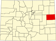 | |
| Towns | ||