

Size of this preview: 800 × 481 pixels. Other resolutions: 320 × 192 pixels | 640 × 385 pixels | 930 × 559 pixels.
Original file (930 × 559 pixels, file size: 121 KB, MIME type: image/jpeg)
Summary
| Description |
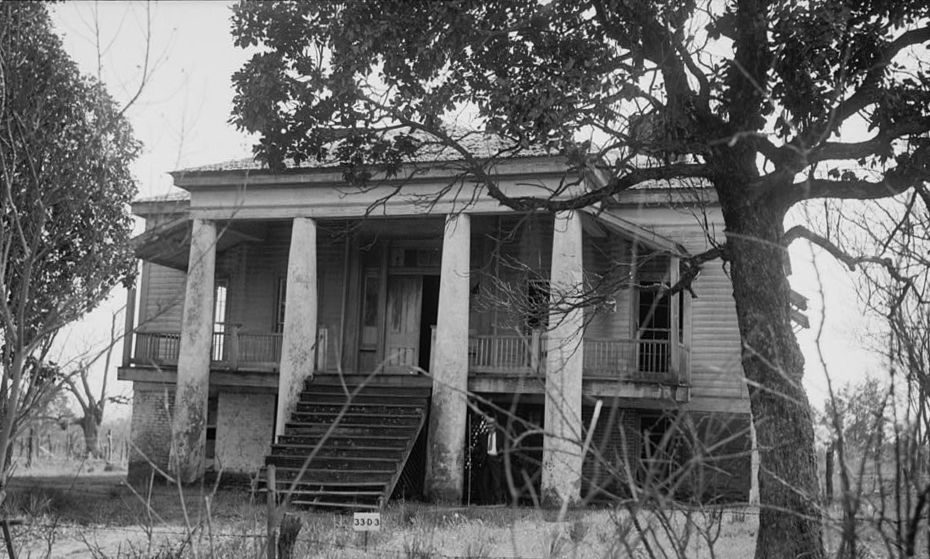
English: Freeman Plantation House — on TX 49, 0.8 mi (1.3 km) west of Jefferson, in Marion County, Texas.
|
|||||
| Date | orig: ?; upload: 2012-03-31 | |||||
| Source |
|
|||||
| Author | Clarence Bulger | |||||
| Other versions |


| Object location | | View this and other nearby images on: OpenStreetMap |
|---|
.jpg¶ms=032.763333_N_-094.370000_E_globe:Earth_class:object_region:US_type:landmark_scale:1500_&language=en)
|
This is an image of a place or building that is listed on the National Register of Historic Places in the United States of America. Its reference number is 69000209. |
Licensing
This work is in the public domain in the United States because it is a work prepared by an officer or employee of the United States Government as part of that person’s official duties under the terms of Title 17, Chapter 1, Section 105 of the US Code.
Note: This only applies to original works of the Federal Government and not to the work of any individual U.S. state, territory, commonwealth, county, municipality, or any other subdivision. This template also does not apply to postage stamp designs published by the United States Postal Service since 1978. (See § 313.6(C)(1) of Compendium of U.S. Copyright Office Practices). It also does not apply to certain US coins; see The US Mint Terms of Use.
|
 | |
| This file has been identified as being free of known restrictions under copyright law, including all related and neighboring rights. | ||
File history
Click on a date/time to view the file as it appeared at that time.
| Date/Time | Thumbnail | Dimensions | User | Comment | |
|---|---|---|---|---|---|
| current | 08:07, 25 May 2021 | | 930 × 559 (121 KB) | CaroleHenson | File:Freeman Plantation House, Jefferson, Texas.jpg cropped 9 % horizontally, 15 % vertically, rotated 1° using CropTool with precise mode. |
File usage
The following pages on the English Wikipedia use this file (pages on other projects are not listed):
.jpg)