

Size of this preview: 800 × 501 pixels. Other resolutions: 320 × 200 pixels | 640 × 401 pixels | 1,024 × 641 pixels | 1,280 × 802 pixels | 2,560 × 1,604 pixels | 4,200 × 2,631 pixels.
Original file (4,200 × 2,631 pixels, file size: 5.39 MB, MIME type: image/png)
Summary
| Description |
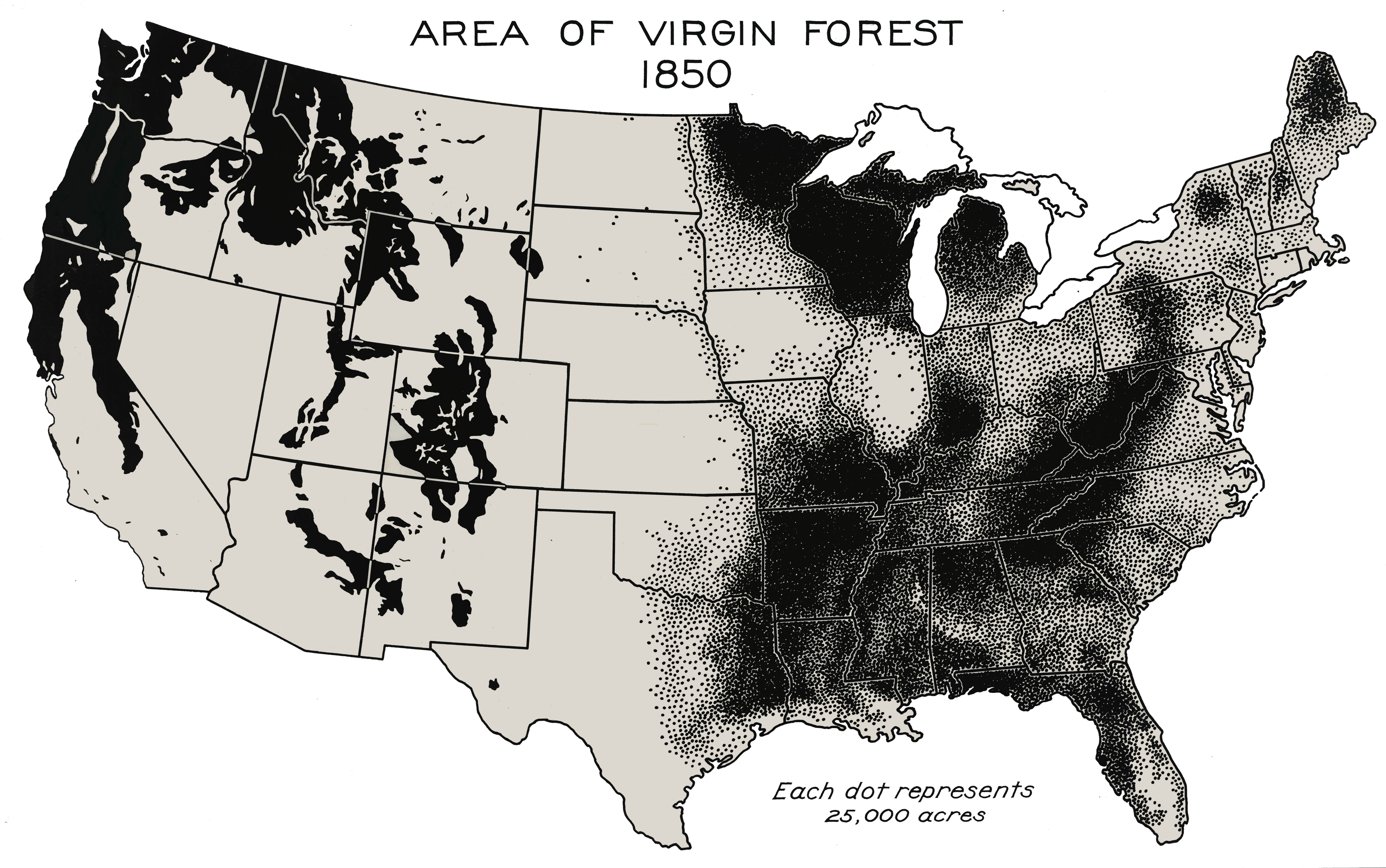
English: Forests never harvested by European settlers or their descendants, 1850. This map of the area of virgin forest in 1850 was compiled by William B. Greeley, who was chief of the U.S. Forest Service from 1920 to 1928, in his 1925 book The Relation of Geography to Timber Supply. This high-resolution version was created by the World Resources Institute from the original map in the U.S. National Archives. [1] This map can be seen as part of a four-image set constituted of File:Virgin Forest in United States, 1620.png, File:Virgin Forest in United States, 1926.png and a last one with protected copy rights[2] |
| Date | |
| Source | Southern Forests Flickr |
| Author | William B. Greeley, US Forest Service |
Licensing
This image is a work of the Forest Service of the United States Department of Agriculture. As a work of the U.S. federal government, the image is in the public domain.
|
- ↑ caption of the original image on Flickr.
- ↑ George Draffan (1992). Virgin Forests Today. Flickr. Southern Forests.
File history
Click on a date/time to view the file as it appeared at that time.
| Date/Time | Thumbnail | Dimensions | User | Comment | |
|---|---|---|---|---|---|
| current | 19:55, 29 April 2012 | | 4,200 × 2,631 (5.39 MB) | Hotshot977 |
File usage
The following pages on the English Wikipedia use this file (pages on other projects are not listed):
Global file usage
The following other wikis use this file:
- Usage on fr.wikipedia.org